Imagine gathering data underneath a dense forest canopy or accessing the intricate labyrinths of an underground mine. The answer lies in the fast-growing market for autonomous drones for mapping GPS-denied areas. But how do these drones navigate the skies and subterranean terrains without the ubiquitous help of GPS signals? Let's delve deep and unravel this drone technology mystery.
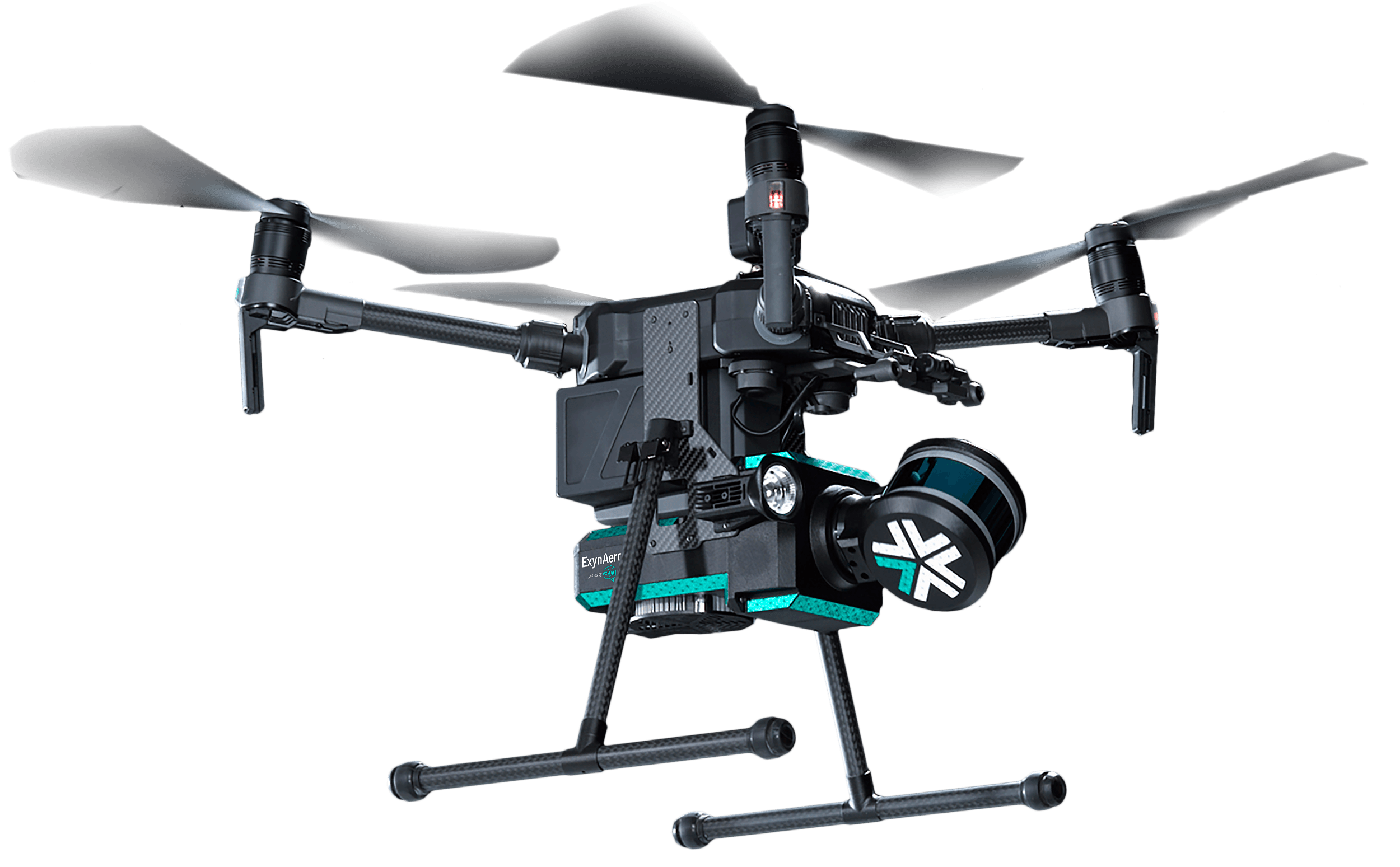
Drones have quickly transformed from recreational novelties to indispensable tools in many industries. But as the world pushes boundaries, there's a surge in demand for drones that can function in areas where GPS signals fail to penetrate. Vast portions of our planet, including complex urban landscapes, dense forests, and underground mines, render typical GPS systems ineffective.
According to recent research, the market size for drones explicitly designed for GPS-denied environments has seen exponential growth over the past few years. Traditional drones rely heavily on a constant GPS signal for navigation and stability while in flight; without it, their functionality can be severely hampered. But drones designed for GPS-denied navigation are different.
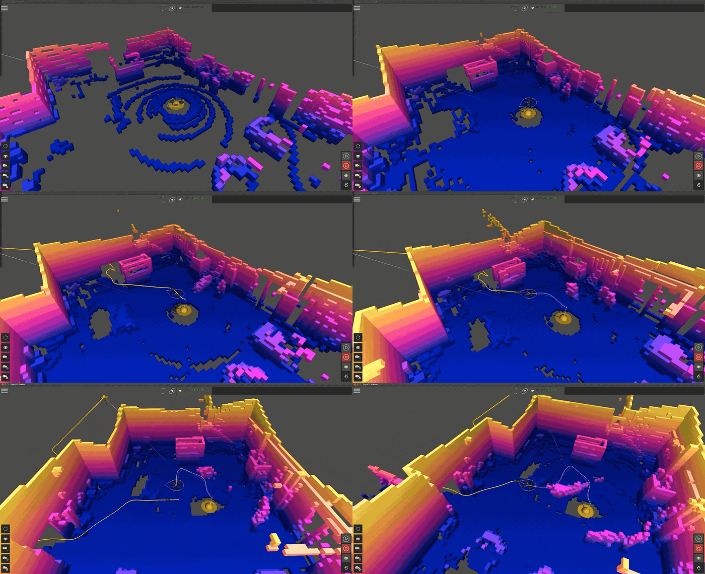
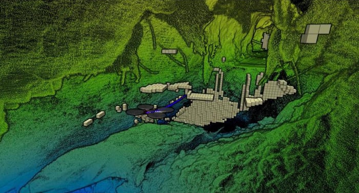
Simultaneous Localization And Mapping (SLAM) is a complex algorithm that allows a robot, such as an autonomous drone, to map an unknown environment while simultaneously tracking its position within it. It's particularly vital in navigating GPS-denied areas such as underground terrain.
SLAM can use various sensors to visualize its surroundings, including LiDAR, ultrasonic sensors, and cameras. LiDAR-based SLAM uses a LiDAR (Light Detection and Ranging) sensor to “see” its environment. Here’s how that process works:

Drones have become synonymous with efficiency and safety within the defense, security, and research sectors. With their ability to hover, maneuver through tight spaces, and relay real-time data, drones provide a level of situational awareness previously considered the realm of science fiction.
One of the standout features of drone technology is its ability to venture into inaccessible areas. Think of regions hampered by rugged terrains, hostile climates, or places too dangerous for human access, such as conflict zones or disaster-stricken locales. With their compact sizes and advanced navigation systems, drones can easily access these regions. This capability becomes crucial when the need for immediate information outweighs the risks of manual intervention.

In surveying, time is of the essence, and accuracy is paramount. Traditionally, surveying methods often demanded extensive human resources, lengthy procedures, and significant financial outlays.
Enter drone surveying using a GPS-denied drone: A harbinger of change in the field. These aerial mavens have not only upended the surveying domain but also infused it with a level of efficiency and accuracy that was previously unimagined. Drones like the ExynAero soar, especially in intricate labyrinths of GPS-denied environments where conventional methods might falter. The ExynAero launches safely and remotely without GPS and BVLOS to efficiently and effortlessly capture beyond-line-of-sight, high-risk data without risking operator safety.
These robots, equipped with collision avoidance technology, effortlessly skim over rugged terrains, within dense forests and other challenging landscapes, capturing data with surgical precision, slashing the time for comprehensive surveys, and proving remarkably cost-effective. By eliminating the need for cumbersome equipment and human exposure to potentially hazardous sites, drone capabilities are redefining the ethos of surveying, making it safer, smarter, and incredibly efficient.

A concept has become prominent in the intersection of the physical and digital realms: digital twins – dynamic, virtual representations of a real-world object or system. And drones? They're the master artists bringing these replicas to life. With their capacity to create intricate 3D models, drone mapping captures every nuance, every contour, and every detail of a physical asset. Whether it's the grandeur of an architectural marvel, the complexity of urban infrastructure, or the vast expanse of natural landscapes, drones ensure that the digital doppelgänger is as close to reality as possible.
But the magic of digital mapping technologies isn't just in replication; it's in the real-time interaction and analysis these virtual models enable. Stakeholders can run simulations, predict wear and tear, and make informed decisions without disturbing the actual asset. This ability is particularly valuable in urban planning, infrastructure maintenance, and environmental studies, where making changes can be costly or disruptive. Exyn Technology uses precise geospatial reality capture mapping to deliver digital twins for VR and AR, capturing high-fidelity 3D models of almost any environment as proactive tools that facilitate better decision-making, streamline operations, and pave the way for a harmonious synergy between the tangible and digital worlds.

Traditionally, infrastructure inspections were manual, labor-intensive, and sometimes dangerous endeavors. Workers often had to dangle from ropes to inspect bridges, climb tall towers, or navigate treacherous terrains around critical infrastructure – all of which came with inherent risks. Drones, with their aerial prowess, have revolutionized this scenario.
These flying marvels can hover close to structures thanks to drone autonomy, capturing high-resolution images and videos that give engineers an unparalleled view of even the most hard-to-reach places. Whether it's a hairline crack on a dam or corrosion on a transmission line, UAVs ensure nothing escapes the keen eye of inspection.

Drones have become synonymous with efficiency and safety within the defense, security, and research sectors. With their ability to hover, maneuver through tight spaces, and relay real-time data, drones provide a level of situational awareness previously considered the realm of science fiction.
One of the standout features of drone technology is its ability to venture into inaccessible areas. Think of regions hampered by rugged terrains, hostile climates, or places too dangerous for human access, such as conflict zones or disaster-stricken locales. With their compact sizes and advanced navigation systems, drones can easily access these regions. This capability becomes crucial when the need for immediate information outweighs the risks of manual intervention.

In surveying, time is of the essence, and accuracy is paramount. Traditionally, surveying methods often demanded extensive human resources, lengthy procedures, and significant financial outlays.
Enter drone surveying using a GPS-denied drone: A harbinger of change in the field. These aerial mavens have not only upended the surveying domain but also infused it with a level of efficiency and accuracy that was previously unimagined. Drones like the ExynAero soar, especially in intricate labyrinths of GPS-denied environments where conventional methods might falter. The ExynAero launches safely and remotely without GPS and BVLOS to efficiently and effortlessly capture beyond-line-of-sight, high-risk data without risking operator safety.
These robots, equipped with collision avoidance technology, effortlessly skim over rugged terrains, within dense forests and other challenging landscapes, capturing data with surgical precision, slashing the time for comprehensive surveys, and proving remarkably cost-effective. By eliminating the need for cumbersome equipment and human exposure to potentially hazardous sites, drone capabilities are redefining the ethos of surveying, making it safer, smarter, and incredibly efficient.

A concept has become prominent in the intersection of the physical and digital realms: digital twins – dynamic, virtual representations of a real-world object or system. And drones? They're the master artists bringing these replicas to life. With their capacity to create intricate 3D models, drone mapping captures every nuance, every contour, and every detail of a physical asset. Whether it's the grandeur of an architectural marvel, the complexity of urban infrastructure, or the vast expanse of natural landscapes, drones ensure that the digital doppelgänger is as close to reality as possible.
But the magic of digital mapping technologies isn't just in replication; it's in the real-time interaction and analysis these virtual models enable. Stakeholders can run simulations, predict wear and tear, and make informed decisions without disturbing the actual asset. This ability is particularly valuable in urban planning, infrastructure maintenance, and environmental studies, where making changes can be costly or disruptive. Exyn Technology uses precise geospatial reality capture mapping to deliver digital twins for VR and AR, capturing high-fidelity 3D models of almost any environment as proactive tools that facilitate better decision-making, streamline operations, and pave the way for a harmonious synergy between the tangible and digital worlds.

Traditionally, infrastructure inspections were manual, labor-intensive, and sometimes dangerous endeavors. Workers often had to dangle from ropes to inspect bridges, climb tall towers, or navigate treacherous terrains around critical infrastructure – all of which came with inherent risks. Drones, with their aerial prowess, have revolutionized this scenario.
These flying marvels can hover close to structures thanks to drone autonomy, capturing high-resolution images and videos that give engineers an unparalleled view of even the most hard-to-reach places. Whether it's a hairline crack on a dam or corrosion on a transmission line, UAVs ensure nothing escapes the keen eye of inspection.
Vast terrains and the unpredictable nature of certain search zones make manual data collection time-consuming and dangerous. Exyn’s autonomous drones run on platform-agnostic AI for aerial and ground-based government, military, commercial flights, and robotic exploration. Our multi-platform robotic autonomy delivers safer and faster ISR and provides SAR teams with precise 3D maps in real time.
With the ExynScout & ExynPak, first responders can generate a precise 3D model of an emergency site, including points of ingress and egress, potential survivors, and structural dangers.
ExynScout on the Ascent Spirit platform has a unique co-axial design that will fit in a backpack when disassembled. Powered by ExynAI, the small airframe can detect and avoid obstacles in real-time while delivering precise 3D maps of extensive areas, from dense forests and steep mountainsides to vast bodies of water or urban landscapes.
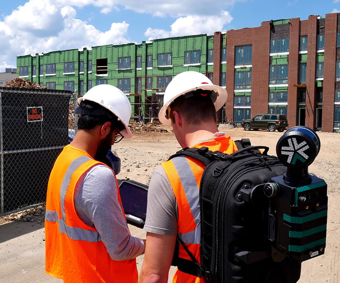
First responders can quickly capture accurate 3D models of accident scenes with the ExynPak, the portable, real-time 3D mapping solution with survey-grade accuracy. Rugged enough to be mounted to a vehicle with the portability to be carried by hand, ExynPak has the following advanced sensory capabilities:
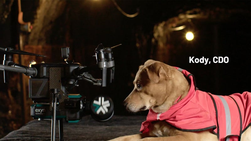
Drones have revolutionized our world, from reshaping land surveys to acting as crucial lifelines in search and rescue operations. Yet, their groundbreaking potential in GPS-denied territories is a testament to human innovation. Exyn’s autonomous drones now navigate, adapt, and deliver unparalleled precision where traditional systems falter. This technology isn't just evolution; it's a revolution.
Ready to witness the future firsthand? Schedule a demo today, and let's explore the uncharted together.