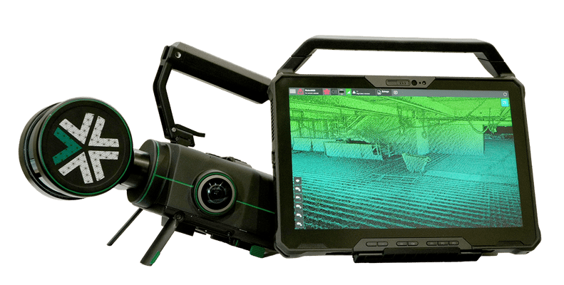
Our modular mapping payload captures survey-grade 3D maps of construction sites in progress. Mounted to an autonomous robot or capturing high fidelity maps by hand, survey teams can track real-time, precise progress and avoid costly rework.
Modular 3D Mapping
Modular 3D Mapping
 For sites requiring more flexibility, Nexys can be handheld or mounted on a backpack/vehicle, providing survey grade accuracy and real-time results for change detection and production updates.
Autonomous Aerial 3D Mapping
Autonomous Aerial 3D Mapping

For larger mapping missions, Nexys can be mounted to a variety of robotic airframes and with the inclusion of Autonomy License pilot them autonomously, without the need for a prior map, GPS or existing infrastructure.
Modular Robotic Autonomy
Modular Robotic Autonomy

For survey teams looking to keep their robots on the ground, Nexys can be combined with a Terrestrial Autonomy license to autonomously pilot ground-based robots like Boston Dynamic's Spot (seen above explore a large area of interest).
Modular 3D Mapping
 For sites requiring more flexibility, Nexys can be handheld or mounted on a backpack/vehicle, providing survey grade accuracy and real-time results for change detection and production updates.
Autonomous Aerial 3D Mapping

For larger mapping missions, Nexys can be mounted to a variety of robotic airframes and with the inclusion of Autonomy License pilot them autonomously, without the need for a prior map, GPS or existing infrastructure.
Modular Robotic Autonomy

For survey teams looking to keep their robots on the ground, Nexys can be combined with a Terrestrial Autonomy license to autonomously pilot ground-based robots like Boston Dynamic's Spot (seen above explore a large area of interest).


Exyn solutions empower construction managers with real-time 3D models preserving time building a complete BIM, preventing costly overwork via early issue detection, and protecting lives by keeping workers away from dangerous areas.
Our customers range from federal contractors to corporate construction managers. And they have one thing in common: appreciation for safe, efficient, sophisticated — and frankly cool — data-capture technology.

“The main purpose of our collaboration with Exyn is to improve our productivity on the construction site. The technology was great ... it was really easy to set the flight routes. We prepared some really difficult, narrow routes but [Exyn’s] Technology achieved them all.”
Takuma NakabayashiArtificial Intelligence Researcher in the AEC Industry, Obayashi Corporation