The Exyn Nexys offers a versatile, economical, and precise approach to data gathering across a range of needs in the oil and gas industries.
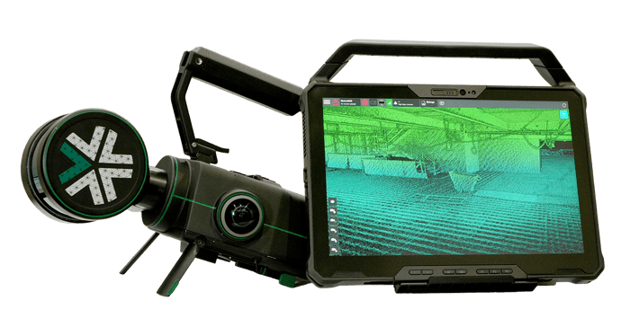
With rapid acquisition of survey-quality data, in-field post-processing for immediate visualization, and a convertible form factor supporting multiple configurations, Nexys can drive efficiency, enhance safety, enable better environmental stewardship, and more informed decision-making.
Learn More About Nexys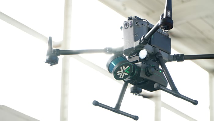
Nexys' modularity means with an additional autonomy license survey teams can quickly mount it to an integrated robot for autonomous aerial- or ground-based mapping missions without the need for GPS, WiFi, or even a pilot-in-the-loop.
Learn MoreFor existing oil and gas infrastructure, a 3D mapping solution like Nexys can be used to regularly scan and inspect the condition of pipelines, platforms, and other critical pieces of infrastructure.
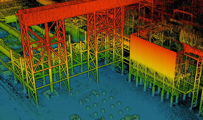
Capable of delivering survey grade accurate maps that can be captured in minutes, a portable system like Nexys is a crucial tool for geospatial survey teams. Once you can capture easily repeatable scans, teams can easily look for changes to assets over time, identifying potential risks, and preparing for any maintenance to reduce downtime.
In oil and gas operations, it's paramount to regularly inspect critical infrastructure for safety and risk management. To ensure we're protecting environment resources and maintaining ongoing operations, inspections teams will need to monitor an ever increasing number of critical infrastructure assets.
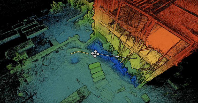
Nexys can assist in identifying geological hazards, like unstable slopes or erosion, which could impact the safety of the operations.
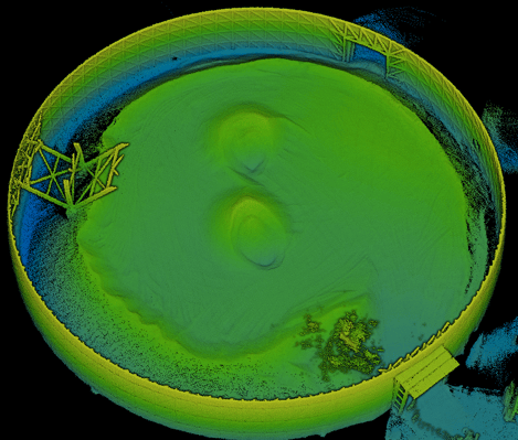
Outdoor stockpiles can be unstable, dangerous, and constantly changing. Keeping track of stockpile volumes is critical for internal and governmental reporting which need to be captured on a regular basis. A 3D mapping tool capable of quickly mapping large volumes which can also process point clouds directly on site would be a necessary tool for any survey team.
Meet Nexys -- a 3D mapping ecosystem capable of portable mapping when you can carry by hand or autonomous when you need a drone to capture for you.
Using Nexys for emergency response planning in the oil & gas industry leverages its advanced 3D mapping capabilities and modular autonomy to ensure rapid, accurate, and safe data capture in potentially hazardous environments.
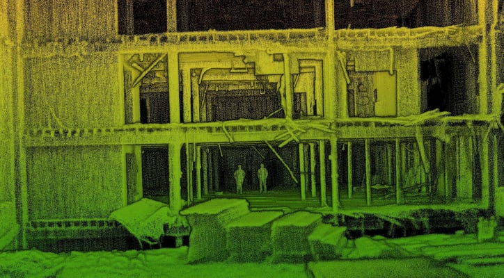
Nexys's advanced mapping and autonomy features make it an invaluable tool for emergency response planning in the oil & gas industry, enhancing safety, preparedness, and operational continuity.
Due to its portability and optional autonomy, Nexys can be deployed in remote or otherwise inaccessible areas, allowing for exploration and monitoring in locations that are difficult to reach with traditional surveying methods.
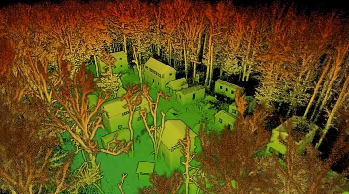
Nexys provides real-time visualization of captured data, which is crucial for immediate decision-making in remote operations. This capability allows for the dynamic adjustment of exploration and monitoring strategies based on the most current environmental data.
For existing oil and gas infrastructure, a 3D mapping solution like Nexys can be used to regularly scan and inspect the condition of pipelines, platforms, and other critical pieces of infrastructure.

Capable of delivering survey grade accurate maps that can be captured in minutes, a portable system like Nexys is a crucial tool for geospatial survey teams. Once you can capture easily repeatable scans, teams can easily look for changes to assets over time, identifying potential risks, and preparing for any maintenance to reduce downtime.
In oil and gas operations, it's paramount to regularly inspect critical infrastructure for safety and risk management. To ensure we're protecting environment resources and maintaining ongoing operations, inspections teams will need to monitor an ever increasing number of critical infrastructure assets.

Nexys can assist in identifying geological hazards, like unstable slopes or erosion, which could impact the safety of the operations.
Outdoor stockpiles can be unstable, dangerous, and constantly changing. Keeping track of stockpile volumes is critical for internal and governmental reporting which need to be captured on a regular basis. A 3D mapping tool capable of quickly mapping large volumes which can also process point clouds directly on site would be a necessary tool for any survey team.

Meet Nexys -- a 3D mapping ecosystem capable of portable mapping when you can carry by hand or autonomous when you need a drone to capture for you.
Using Nexys for emergency response planning in the oil & gas industry leverages its advanced 3D mapping capabilities and modular autonomy to ensure rapid, accurate, and safe data capture in potentially hazardous environments.

Nexys's advanced mapping and autonomy features make it an invaluable tool for emergency response planning in the oil & gas industry, enhancing safety, preparedness, and operational continuity.
Due to its portability and optional autonomy, Nexys can be deployed in remote or otherwise inaccessible areas, allowing for exploration and monitoring in locations that are difficult to reach with traditional surveying methods.

Nexys provides real-time visualization of captured data, which is crucial for immediate decision-making in remote operations. This capability allows for the dynamic adjustment of exploration and monitoring strategies based on the most current environmental data.