---
title: Autonomous LiDAR Drone Mapping | Exyn Technologies
description: Discover the power of autonomous LiDAR drones and how they are revolutionizing workflows for surveying and mapping.
image: https://www.exyn.com/hubfs/Bishop_ExynAero_social.jpg
---
[ ](https://www.exyn.com/?hsLang=en)
[](https://cta-redirect.hubspot.com/cta/redirect/8300473/57396f92-3fbc-42c5-bbd2-fbf6fcbf28fe)
[](https://cta-redirect.hubspot.com/cta/redirect/8300473/57396f92-3fbc-42c5-bbd2-fbf6fcbf28fe)
  
# Revolutionzing Surveying and Inspection with Autonomous LiDAR Drones
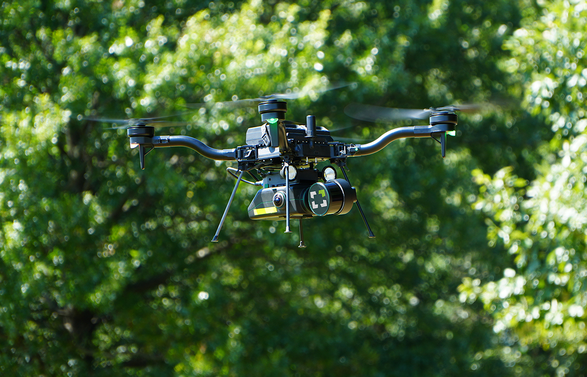
In an industry where precision, efficiency, and safety are paramount, autonomous **LiDAR drones** are transforming the landscape of surveying workflows in construction, underground cavity monitoring, industrial inspection, and geospatial mapping. By combining state-of-the-art sensors with advanced software algorithms, our drones can autonomously navigate complex environments and collect high-resolution data with precision.
[](https://cta-redirect.hubspot.com/cta/redirect/8300473/57396f92-3fbc-42c5-bbd2-fbf6fcbf28fe)
[Learn More](https://www.exyn.com/products/exyn-aero-dj34?hsLang=en)
**

understanding autonomous lidar drones
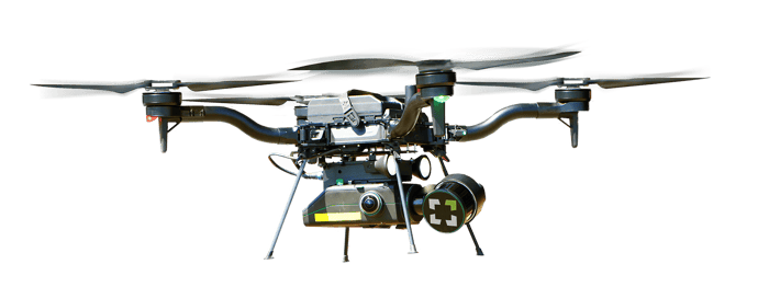
Autonomous **LiDAR drones**, equipped with Light Detection and Ranging (LiDAR) technology, are changing the game in data collection. Using advanced LiDAR-based SLAM (Simultaneous Localization and Mapping), these drones navigate autonomously, even in environments where GPS is unreliable. They create detailed point clouds, capturing data with unparalleled accuracy and detail.
[Learn More about SLAM](https://www.exyn.com/news/difference-between-online-and-offline-slam?hsLang=en)

The AL4 Advantage: Autonomy Level 4
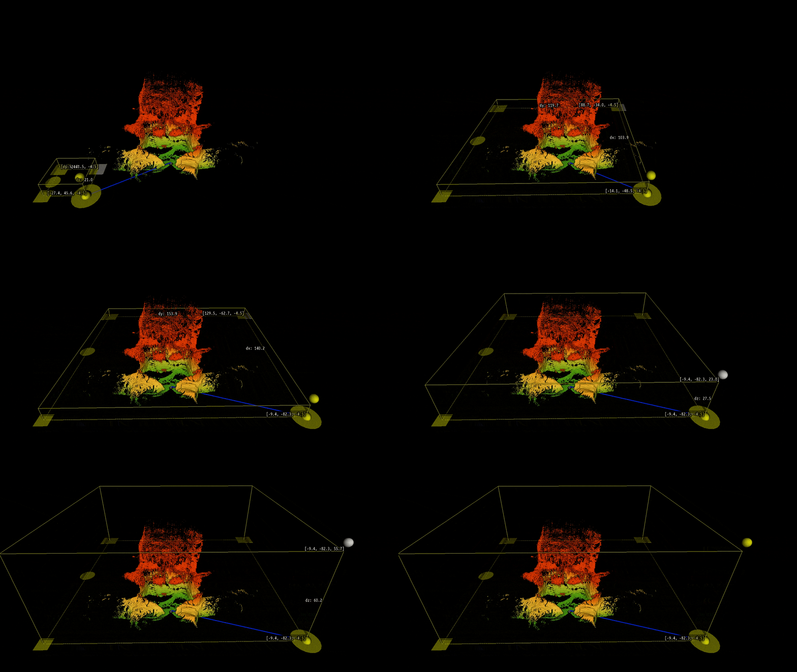
At Exyn Technologies, we're proud to offer AL4 - Autonomy Level 4 - the highest level of aerial autonomy currently available on all of our robots. This means our drones can navigate complex environments entirely autonomously, without any human pilot intervention. Operators simply have to define an area of interest and ExynAero chooses it's own waypoints to cover the entire scan in real time.
This is the algorithm at the heart of ExynAI which powers the autonomous ExynAero and portable ExynPak.
[Learn More about Autonomy Level 4](https://www.exyn.com/news/exyn-drones-achieve-autonomy-level-4?hsLang=en)

## How Does SLAM Using LiDAR System Work?
Simultaneous Localization And Mapping (SLAM) is a complex algorithm that allows a robot, such as an autonomous drone, to map an unknown environment while simultaneously tracking its position within it. It's particularly vital in navigating GPS-denied areas such as underground terrain.
SLAM 3D-mapping can use various sensors to visualize its surroundings, including LiDAR, ultrasonic sensors, and cameras. LiDAR-based SLAM uses a LiDAR (Light Detection and Ranging) sensor to “see” its environment. Here’s how that process works:
A LiDAR sensor emits laser pulses and measures the time it takes for the laser to reflect from surrounding objects.
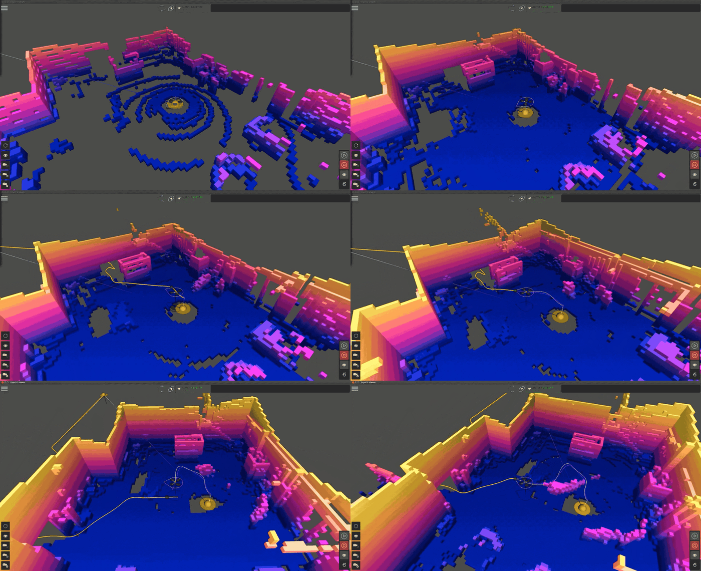
ExynAI creates a 3D point cloud map of its environment by analyzing where these points are in relation to the robot's internal measurement unit (IMU)
ExynAI then transforms the dense point cloud map into a voxel grid to estimate its position, allowing it to find safe flight corridors and navigate its environment intelligently.
[Read More about SLAM 3D-mapping](https://www.exyn.com/slam-3d-mapping?hsLang=en)

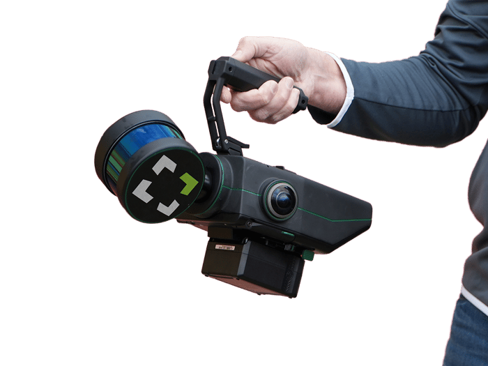
### Pros of using LiDAR-based laser scanner:
**GPS-Independent:** SLAM systems function in enclosed spaces with feature-rich environments where GPS is degraded or unavailable.
**No Light, No Problem:** LiDAR-based SLAM systems can operate with little to no light, making it perfect for overnight inspections, search & rescue, and surveying hard to reach areas.
**Real-Time Mapping:** SLAM systems create maps on the go, adapting to dynamic obstacles while capturing a complete, accurate 3D model.
**Survey-Grade Accuracy:** after capture, rich 3D point clouds can be post processed and geo-referenced for survey grade accuracy directly onsite via a ruggedized tablet. [Learn More about SLAM](https://www.exyn.com/lidar-mapping-technology?hsLang=en)
   
## Industrial Applications for Autonomous Aerial LiDAR Drones Mapping and Survey
Mining
### Mining and Quarrying
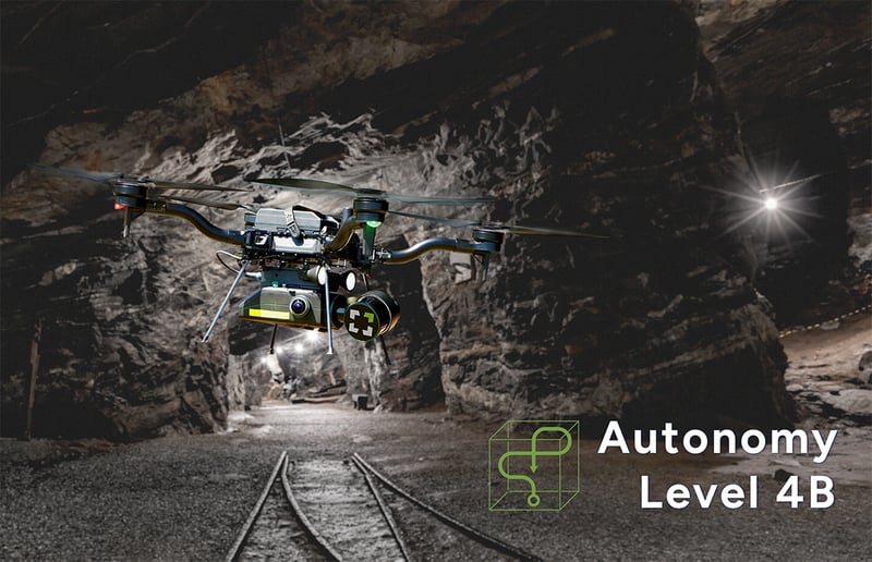
In [the mining industry](https://www.researchgate.net/publication/368220014_APPLICATION_OF_DRONES_IN_MINING_INDUSTRY_-RULES_GUIDELINES_AND_CASE_STUDY), autonomous LiDAR drones are revolutionizing the way underground and open-pit mines are surveyed and managed. They can safely map and model mine shafts, tunnels, working stopes, and open pits, providing valuable data for volume calculations, structural integrity assessments, and planning of mining operations. This technology significantly improves safety by reducing the need for human presence in potentially dangerous environments. [You can read more in a whitepaper comparing an autonomous LiDAR drone to a traditional CMS method.](https://www.exyn.com/exynaero-vs-cms?hsLang=en)
Construction and Infrastructure
### Construction and Infrastructure Inspection
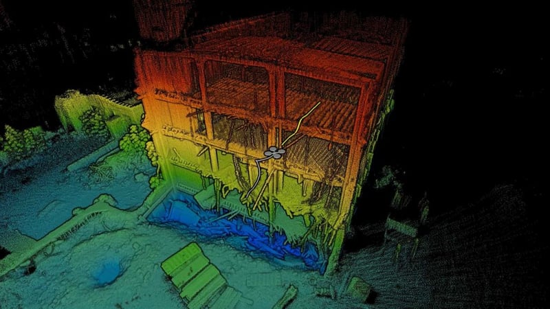
In construction, these drones can be used for site surveying and monitoring progress. They provide accurate and up-to-date 3D models of construction sites, which helps in efficient planning and detecting potential issues early. For infrastructure, they assist in the inspection and maintenance of bridges, buildings, and other structures, especially in hard-to-reach areas, ensuring structural integrity and safety.
Autonomous LiDAR drones are revolutionizing the field of construction and infrastructure inspection by offering a blend of safety, efficiency, and precision that was previously unattainable. These drones provide significant advantages over traditional surveying and inspection methods.
- **Construction Site Mapping and Monitoring:** In the construction industry, keeping track of ongoing progress and ensuring that projects adhere to their initial designs are crucial. LiDAR drones excel in creating high-resolution 3D maps and models of construction sites. These models can be used for tracking progress, comparing actual construction against architectural plans, and identifying discrepancies early. They also assist in calculating volumes of materials like earth moved or concrete poured, ensuring accurate and efficient resource allocation.
- **Infrastructure Inspection and Maintenance:** For existing infrastructure such as bridges, buildings, dams, and roads, regular inspection and maintenance are key to ensuring safety and longevity. Autonomous LiDAR drones can safely inspect these structures, providing detailed images and 3D models that help engineers identify potential issues like cracks, corrosion, or structural weaknesses. This is especially beneficial for inspecting hard-to-reach areas like bridge undersides, high-rise building exteriors, or dam walls.
- **Risk Assessment and Safety Planning:** Before the commencement of any construction project, it's important to assess the site for potential risks. LiDAR drones can survey the area, identifying hazards like unstable ground, nearby water bodies, or overhead utilities. This information is crucial for developing safety plans and mitigation strategies to protect workers and the public.
Search & Rescue
### Search & Rescue Operations
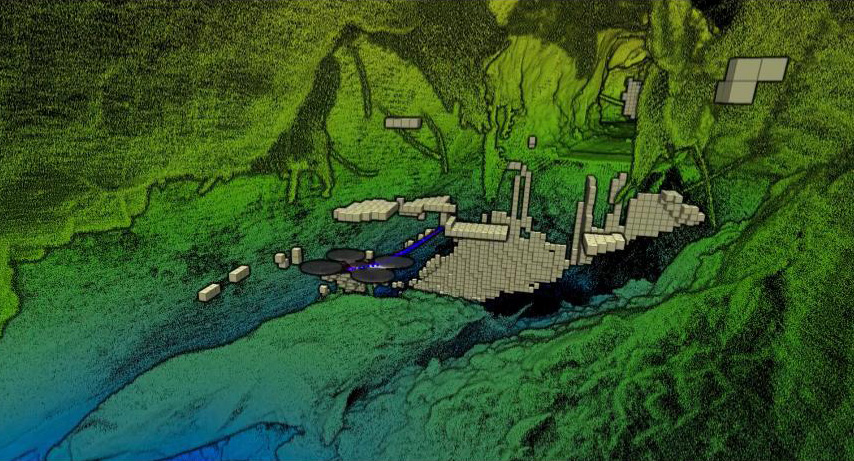
Autonomous LiDAR drones are increasingly becoming a vital asset in search and rescue (SAR) operations due to their ability to rapidly and safely survey large and often inaccessible areas. These drones offer a unique set of capabilities that can significantly enhance the efficiency and effectiveness of SAR missions. Here's how they are being utilized:
- **Rapid Area Scanning:** In SAR operations, time is of the essence. Autonomous LiDAR drones can quickly cover vast areas, much faster than ground teams or manned aircraft. They can scan forests, mountains, deserts, or water bodies, providing real-time data to rescue teams. This rapid scanning capability is crucial for locating missing persons or assessing areas affected by natural disasters.
- **Navigating Challenging Terrains:** Many SAR missions occur in environments that are difficult or dangerous to access on foot or with traditional vehicles. Autonomous drones can navigate these challenging terrains with ease, be it dense forests, rugged mountains, or disaster-stricken urban areas. Their ability to fly autonomously, guided by advanced LiDAR-based SLAM (Simultaneous Localization and Mapping) algorithms, allows them to operate effectively in GPS-denied environments.
- **Night-time and Low Visibility Operations:** LiDAR sensors do not rely on visible light and can create accurate 3D maps even in complete darkness or under conditions of low visibility like fog or smoke. This makes autonomous LiDAR drones especially valuable for night-time SAR missions or in situations where visibility is impaired, such as post-fire or post-explosion environments.
- **Detailed Terrain Mapping for Planning Rescue Operations:** LiDAR drones provide high-resolution 3D maps of the terrain, which can be critical for planning rescue operations. These maps help SAR teams understand the geography, plan the safest and quickest routes for ground teams, and identify potential hazards. They also help in determining the most suitable areas for setting up base camps or deploying additional resources.
- **Locating Survivors in Disaster Scenarios:** Following natural disasters such as earthquakes or hurricanes, finding survivors trapped under debris or in isolated areas is a top priority. LiDAR drones can help identify signs of life under rubble or in partially collapsed structures by detecting heat signatures or movement, and by providing detailed structural assessments.
Utility and Energy Inspection
### Utility and Energy Infrastructure Inspection
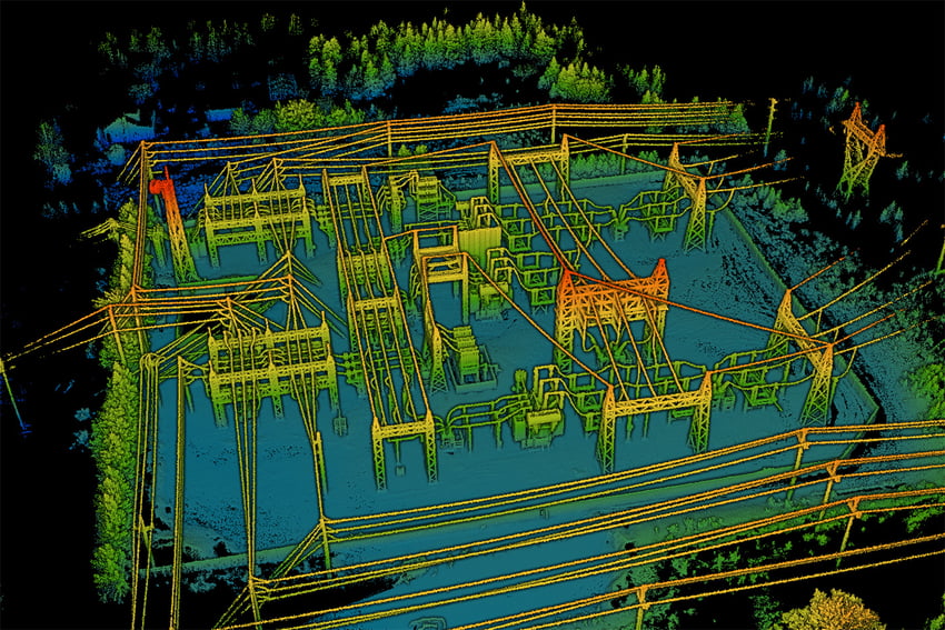
In the utility sector, these drones are used for inspecting power lines, pipelines, and other infrastructure. Traditionally, this task requires manual inspection or the use of manned aircraft, both of which can be risky, time-consuming, and expensive. Autonomous drones can safely and efficiently survey power lines, even in remote or difficult-to-access areas. They can detect issues such as damaged cables, worn insulators, or vegetation encroachment, which are potential hazards leading to power outages or wildfires.
- **Inspection of Power Lines:** LiDAR drones can safely and efficiently inspect power lines for wear and tear, damage, or vegetation encroachment. They can detect issues like sagging lines, damaged insulators, and potential points of failure, reducing the risk of power outages and enhancing grid reliability.
- **Vegetation Management:** They assist in identifying areas where vegetation poses a risk to power lines, helping in planning maintenance and reducing the risk of vegetation-induced faults or fires.
- **Pipeline Surveys:** Drones are used for regular monitoring of pipelines, particularly in remote or hard-to-access areas. They can identify potential issues like leaks, corrosion, or damages caused by natural disasters or human activities.
- **Environmental Impact Assessments:** LiDAR drones help in assessing the environmental impact of pipelines, monitoring changes in surrounding ecosystems, and ensuring compliance with environmental regulations.
The use of autonomous LiDAR drones in the utility and energy sector not only enhances the efficiency and safety of inspections and maintenance but also plays a crucial role in environmental monitoring, disaster response, and the overall management of energy resources. Their ability to gather detailed data in difficult-to-access areas and their versatility across various applications make them invaluable assets in this sector.
### Mining and Quarrying

In [the mining industry](https://www.researchgate.net/publication/368220014_APPLICATION_OF_DRONES_IN_MINING_INDUSTRY_-RULES_GUIDELINES_AND_CASE_STUDY), autonomous LiDAR drones are revolutionizing the way underground and open-pit mines are surveyed and managed. They can safely map and model mine shafts, tunnels, working stopes, and open pits, providing valuable data for volume calculations, structural integrity assessments, and planning of mining operations. This technology significantly improves safety by reducing the need for human presence in potentially dangerous environments. [You can read more in a whitepaper comparing an autonomous LiDAR drone to a traditional CMS method.](https://www.exyn.com/exynaero-vs-cms?hsLang=en)
### Construction and Infrastructure Inspection

In construction, these drones can be used for site surveying and monitoring progress. They provide accurate and up-to-date 3D models of construction sites, which helps in efficient planning and detecting potential issues early. For infrastructure, they assist in the inspection and maintenance of bridges, buildings, and other structures, especially in hard-to-reach areas, ensuring structural integrity and safety.
Autonomous LiDAR drones are revolutionizing the field of construction and infrastructure inspection by offering a blend of safety, efficiency, and precision that was previously unattainable. These drones provide significant advantages over traditional surveying and inspection methods.
- **Construction Site Mapping and Monitoring:** In the construction industry, keeping track of ongoing progress and ensuring that projects adhere to their initial designs are crucial. LiDAR drones excel in creating high-resolution 3D maps and models of construction sites. These models can be used for tracking progress, comparing actual construction against architectural plans, and identifying discrepancies early. They also assist in calculating volumes of materials like earth moved or concrete poured, ensuring accurate and efficient resource allocation.
- **Infrastructure Inspection and Maintenance:** For existing infrastructure such as bridges, buildings, dams, and roads, regular inspection and maintenance are key to ensuring safety and longevity. Autonomous LiDAR drones can safely inspect these structures, providing detailed images and 3D models that help engineers identify potential issues like cracks, corrosion, or structural weaknesses. This is especially beneficial for inspecting hard-to-reach areas like bridge undersides, high-rise building exteriors, or dam walls.
- **Risk Assessment and Safety Planning:** Before the commencement of any construction project, it's important to assess the site for potential risks. LiDAR drones can survey the area, identifying hazards like unstable ground, nearby water bodies, or overhead utilities. This information is crucial for developing safety plans and mitigation strategies to protect workers and the public.
### Search & Rescue Operations

Autonomous LiDAR drones are increasingly becoming a vital asset in search and rescue (SAR) operations due to their ability to rapidly and safely survey large and often inaccessible areas. These drones offer a unique set of capabilities that can significantly enhance the efficiency and effectiveness of SAR missions. Here's how they are being utilized:
- **Rapid Area Scanning:** In SAR operations, time is of the essence. Autonomous LiDAR drones can quickly cover vast areas, much faster than ground teams or manned aircraft. They can scan forests, mountains, deserts, or water bodies, providing real-time data to rescue teams. This rapid scanning capability is crucial for locating missing persons or assessing areas affected by natural disasters.
- **Navigating Challenging Terrains:** Many SAR missions occur in environments that are difficult or dangerous to access on foot or with traditional vehicles. Autonomous drones can navigate these challenging terrains with ease, be it dense forests, rugged mountains, or disaster-stricken urban areas. Their ability to fly autonomously, guided by advanced LiDAR-based SLAM (Simultaneous Localization and Mapping) algorithms, allows them to operate effectively in GPS-denied environments.
- **Night-time and Low Visibility Operations:** LiDAR sensors do not rely on visible light and can create accurate 3D maps even in complete darkness or under conditions of low visibility like fog or smoke. This makes autonomous LiDAR drones especially valuable for night-time SAR missions or in situations where visibility is impaired, such as post-fire or post-explosion environments.
- **Detailed Terrain Mapping for Planning Rescue Operations:** LiDAR drones provide high-resolution 3D maps of the terrain, which can be critical for planning rescue operations. These maps help SAR teams understand the geography, plan the safest and quickest routes for ground teams, and identify potential hazards. They also help in determining the most suitable areas for setting up base camps or deploying additional resources.
- **Locating Survivors in Disaster Scenarios:** Following natural disasters such as earthquakes or hurricanes, finding survivors trapped under debris or in isolated areas is a top priority. LiDAR drones can help identify signs of life under rubble or in partially collapsed structures by detecting heat signatures or movement, and by providing detailed structural assessments.
### Utility and Energy Infrastructure Inspection

In the utility sector, these drones are used for inspecting power lines, pipelines, and other infrastructure. Traditionally, this task requires manual inspection or the use of manned aircraft, both of which can be risky, time-consuming, and expensive. Autonomous drones can safely and efficiently survey power lines, even in remote or difficult-to-access areas. They can detect issues such as damaged cables, worn insulators, or vegetation encroachment, which are potential hazards leading to power outages or wildfires.
- **Inspection of Power Lines:** LiDAR drones can safely and efficiently inspect power lines for wear and tear, damage, or vegetation encroachment. They can detect issues like sagging lines, damaged insulators, and potential points of failure, reducing the risk of power outages and enhancing grid reliability.
- **Vegetation Management:** They assist in identifying areas where vegetation poses a risk to power lines, helping in planning maintenance and reducing the risk of vegetation-induced faults or fires.
- **Pipeline Surveys:** Drones are used for regular monitoring of pipelines, particularly in remote or hard-to-access areas. They can identify potential issues like leaks, corrosion, or damages caused by natural disasters or human activities.
- **Environmental Impact Assessments:** LiDAR drones help in assessing the environmental impact of pipelines, monitoring changes in surrounding ecosystems, and ensuring compliance with environmental regulations.
The use of autonomous LiDAR drones in the utility and energy sector not only enhances the efficiency and safety of inspections and maintenance but also plays a crucial role in environmental monitoring, disaster response, and the overall management of energy resources. Their ability to gather detailed data in difficult-to-access areas and their versatility across various applications make them invaluable assets in this sector.


the exyn edge
## Nexys: Modular Autonomy & 3D Mapping
Nexys is rugged and configurable. It can be quickly and easily switched between a variety of configurations - handheld, backpack, aerial robot, terrestrial robot, vehicle, pole, custom configurations. Built for the most extreme environments, users have the flexibility and cost efficiency to use one device in any mapping environment.
The resulting point cloud is a survey-grade 3D model that can be imported into a variety of construction, geospatial, or other analytical software for inspection and further analysis.
[Learn More about Nexys](https://www.exyn.com/en/products/exyn-nexys?hsLang=en)

Copyright © 2026 Exyn Technologies
[(215) 999-0200](tel:+1%20215%20999-0200)
[Contact Us](https://www.exyn.com/about/contact?hsLang=en) [Do Not Sell or Share My Personal Information](https://www.exyn.com/lidar-drone#) [ Data Privacy Rights Form](https://my.datasubject.com/AzqgT7Th06O5n7f37/26903)