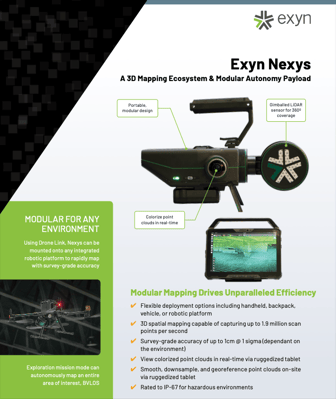
Nexys is a modular mapping and surveying ecosystem that allows users to quickly capture highly accurate, colorized, real-time 3D point clouds in complex, dangerous, or inhospitable environments like those in the mining, AEC, and geospatial industries.
The Nexys Ecosystem of accessories enables it to be handheld, carried in a backpack, mounted to a vehicle, piloted on an aerial robot, or -- using our industry-leading AL4 volumetric exploration -- it can autonomously navigate aerial and ground based robots.
Download your copy of the Nexys product sheet to learn how 3D spatial mapping could revolutionize your surveying workflows.
3D Mapping Ecosystem &
Modular Autonomy Payload
Download your copy of the Nexys Product Sheet