Makes mapping faster, safer, and more efficient than ever before.
Our proprietary autonomy algorithms, coupled with our SLAM-based LiDAR scanning technology deliver survey-grade results without a pilot.
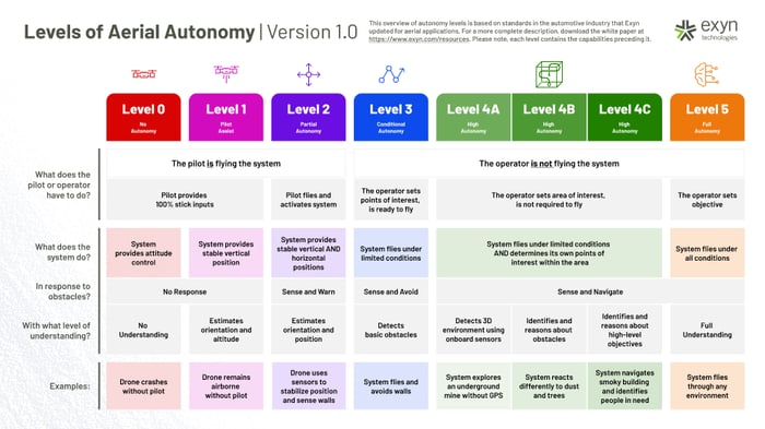
Leveraging Autonomy Level 4 (AL-4), the operator simply sets the area to scan and the system determines its own route to ensure complete environmental coverage, detects the 3D environment, and identifies and reasons about obstacles and high-level objectives - even in GPS-denied, hazardous, and unilluminated environments.
Learn More about Autonomy Levels

With the Nexys ecosystem, you can choose to use our AL4 autonomy on a drone or terrestrial robot, or you can select a mapping-only solution depending on your requirements.
We make it easy to start with a mapping-only solution, then, if your needs expand to require autonomy, you can license the software quickly and easily with no downtime.