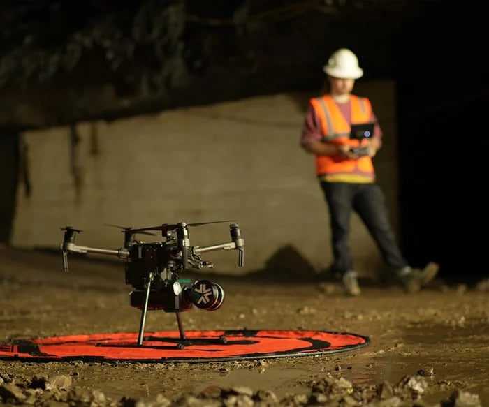
In underground mining, the demands for high precision and utmost safety have led to the integration of innovative technology. One of the most transformative advancements in recent years is the rise of underground drone mapping. The merging of drone technology with software designed for the mining industry has ushered in a new era of exploration and safety.
Exyn Technologies, among leading mining technology firms, stands at the forefront of this revolution.
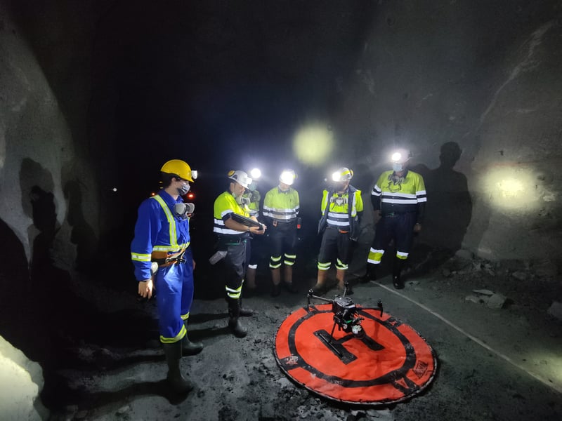
Mining operations often delve far beyond the reach of conventional GPS signals. These GPS-denied environments present a significant challenge: how do you accurately map and survey regions where traditional positioning systems can't operate?
Autonomous drones for 3D mapping thrive in these conditions. Unlike conventional survey tools that rely heavily on GPS, modern mining survey drones use advanced sensors and algorithms to determine their position. Here's how they're reshaping underground exploration:
This technology enables drones to construct a map of their surroundings while keeping track of their current location, even without GPS. Using onboard cameras and/or LiDAR sensors, drones create detailed point clouds of the environment, allowing them to navigate and avoid obstacles autonomously.
SLAM is a computational method vital in navigating GPS-denied areas like caves. To learn more and fly along to experience autonomous 3D mapping, click here.
SLAM relies on diverse sensors to “see” its surroundings, including LiDAR, ultrasonic sensors, and cameras. LiDAR-based SLAM uses a LiDAR (Light Detection and Ranging) sensor to “see” its environment. Here’s how that process works:
Exyn's algorithm delivers accurate, survey-grade 3D maps in real-time. At the same time, our SLAM pipeline enables the robot to autonomously navigate in many extreme field conditions, including GPS- and comms-denied environments with little to no light. By harnessing these technologies, mining drones provide a safe and efficient solution to the challenges of GPS-denied environments, ensuring that every corner of a mine is mapped with accuracy and detail.
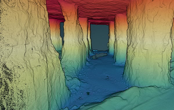
Room and pillar formations are characterized by a network of excavated rooms separated by solid pillars of untouched ore. While efficient for mineral extraction, these designs present various challenges to miners. Navigating this intricate maze can be treacherous due to potential collapses, air quality issues, and uneven terrain. Moreover, ensuring the structural integrity of pillars is essential, as their weakening could jeopardize the entire mine's stability.
Enter drone technology: these airborne marvels are tailor-made for intricate environments, and they effortlessly glide through the tightest of spaces, providing real-time, high-resolution visual data, mapping the entire room and pillar structure in detail, helping engineers assess pillar stability and detect early signs of wear or potential danger zones. By leveraging drone technology, survey teams achieve a safer and more comprehensive understanding of room and pillar configurations without the risks of manual exploration.
Autonomous drones effortlessly navigate through narrow passageways, deep vertical shafts, and other challenging terrains where manual exploration might pose risks or prove impossible. This ability to safely access and inspect areas that might be dangerous or inaccessible to humans enables visualization of structural dangers before operations begin.
ExynAI allows flight beyond visual line-of-sight, wireless communications, or GPS. With Level 4 Autonomy (higher than competitive products like Hovermap), this technology can map an area equal to the size of nine football stadiums in a single flight, quickly traveling into the most intricate areas of a mine. Learn more about what this technology can do and see a flight here.
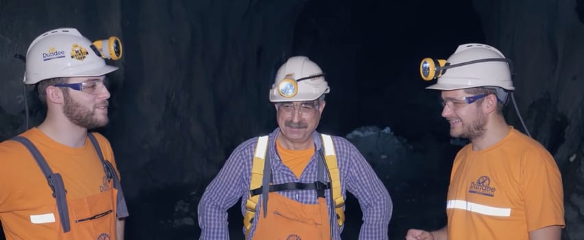
Worker safety remains paramount in the mining industry. A drone for mining will provide a new layer of protection by conducting surveillance in unstable or hazardous zones, delivering immediate data to support rapid response to emergencies. These devices are instrumental in creating a safer environment for workers by providing insights into potential risks.
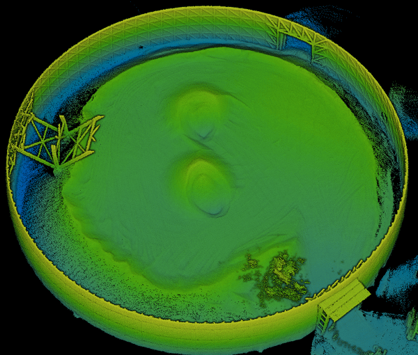
Accurate measurement of stockpiles is vital for inventory control and financial reporting. Drones are equipped to measure volumes with pinpoint accuracy, replacing traditional methods that often result in errors. Automated and frequent stockpile measurements ensure that inventory data is always up-to-date and reliable.
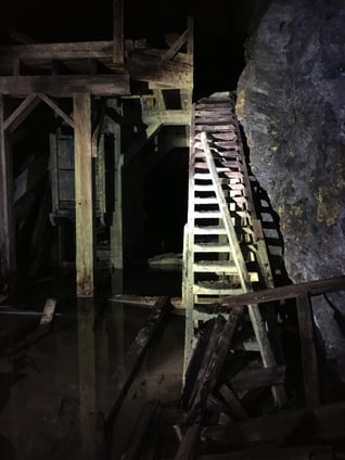
Mine restoration is been quickly becoming more and more important in the mining industry. As sites get decommissioned, and operations cease, it becomes crucial to return these areas to a state that’s ecologically sound and sustainable. However, the post-mining phase isn't just about reclamation; it's also about the opportunity to identify leftover resources, ensuring that literally no stone remains unturned.
Drones now deploy to map and analyze mines that have long ceased operations to identify overlooked pockets of valuable resources. By providing a comprehensive and accurate view of the mine's layout and geology, surveyors can pinpoint areas where minerals, metals, or other resources are likely still present.

Mining operations often delve far beyond the reach of conventional GPS signals. These GPS-denied environments present a significant challenge: how do you accurately map and survey regions where traditional positioning systems can't operate?
Autonomous drones for 3D mapping thrive in these conditions. Unlike conventional survey tools that rely heavily on GPS, modern mining survey drones use advanced sensors and algorithms to determine their position. Here's how they're reshaping underground exploration:
This technology enables drones to construct a map of their surroundings while keeping track of their current location, even without GPS. Using onboard cameras and/or LiDAR sensors, drones create detailed point clouds of the environment, allowing them to navigate and avoid obstacles autonomously.
SLAM is a computational method vital in navigating GPS-denied areas like caves. To learn more and fly along to experience autonomous 3D mapping, click here.
SLAM relies on diverse sensors to “see” its surroundings, including LiDAR, ultrasonic sensors, and cameras. LiDAR-based SLAM uses a LiDAR (Light Detection and Ranging) sensor to “see” its environment. Here’s how that process works:
Exyn's algorithm delivers accurate, survey-grade 3D maps in real-time. At the same time, our SLAM pipeline enables the robot to autonomously navigate in many extreme field conditions, including GPS- and comms-denied environments with little to no light. By harnessing these technologies, mining drones provide a safe and efficient solution to the challenges of GPS-denied environments, ensuring that every corner of a mine is mapped with accuracy and detail.

Room and pillar formations are characterized by a network of excavated rooms separated by solid pillars of untouched ore. While efficient for mineral extraction, these designs present various challenges to miners. Navigating this intricate maze can be treacherous due to potential collapses, air quality issues, and uneven terrain. Moreover, ensuring the structural integrity of pillars is essential, as their weakening could jeopardize the entire mine's stability.
Enter drone technology: these airborne marvels are tailor-made for intricate environments, and they effortlessly glide through the tightest of spaces, providing real-time, high-resolution visual data, mapping the entire room and pillar structure in detail, helping engineers assess pillar stability and detect early signs of wear or potential danger zones. By leveraging drone technology, survey teams achieve a safer and more comprehensive understanding of room and pillar configurations without the risks of manual exploration.
Autonomous drones effortlessly navigate through narrow passageways, deep vertical shafts, and other challenging terrains where manual exploration might pose risks or prove impossible. This ability to safely access and inspect areas that might be dangerous or inaccessible to humans enables visualization of structural dangers before operations begin.
ExynAI allows flight beyond visual line-of-sight, wireless communications, or GPS. With Level 4 Autonomy (higher than competitive products like Hovermap), this technology can map an area equal to the size of nine football stadiums in a single flight, quickly traveling into the most intricate areas of a mine. Learn more about what this technology can do and see a flight here.

Worker safety remains paramount in the mining industry. A drone for mining will provide a new layer of protection by conducting surveillance in unstable or hazardous zones, delivering immediate data to support rapid response to emergencies. These devices are instrumental in creating a safer environment for workers by providing insights into potential risks.

Accurate measurement of stockpiles is vital for inventory control and financial reporting. Drones are equipped to measure volumes with pinpoint accuracy, replacing traditional methods that often result in errors. Automated and frequent stockpile measurements ensure that inventory data is always up-to-date and reliable.

Mine restoration is been quickly becoming more and more important in the mining industry. As sites get decommissioned, and operations cease, it becomes crucial to return these areas to a state that’s ecologically sound and sustainable. However, the post-mining phase isn't just about reclamation; it's also about the opportunity to identify leftover resources, ensuring that literally no stone remains unturned.
Drones now deploy to map and analyze mines that have long ceased operations to identify overlooked pockets of valuable resources. By providing a comprehensive and accurate view of the mine's layout and geology, surveyors can pinpoint areas where minerals, metals, or other resources are likely still present.

An underground gold mine in Stewart, British Columbia, closed since the 1940s, became the stage for an impressive showcase of drone mapping technology by Exyn Technologies. Ascot Resources, experts in gold and silver mining, partnered with Exyn to harness their autonomous drone technology to determine the residual reserves in this ancient mine.
Exyn's drone used advanced 3D LiDAR to autonomously navigate underground spaces, creating real-time, detailed 3D maps. The mapping process occurred without human intervention, reducing risks and providing Ascot Resources with precise data, a significant upgrade from the older 2D maps that only allowed for educated guesswork regarding the mine's potential.
This new data offered insights into previously mined areas and the location of new core samples, helping Ascot Resources make informed predictions about deposits and ultimately enhancing their appeal to potential investors.
The success story in Stewart is an exciting hint at the potential future of abandoned mines across the U.S. Many of these mines remain untouched not because they lack resources but due to the technological limitations of their era.
Download Our Customer Story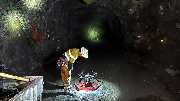
The further survey teams from underground, the safer they are. Remote technologies deliver data without putting human lives at risk. Tele-remote and semi-autonomous systems keep teams above ground and farther away from dangerous areas.
Using traditional methods, survey teams map open, active stopes from their berm, generally considered the most dangerous part of a mine. If a blast happened to break too far under the ridge, it could create a potential collapse into the cavity. Virtual mapping prevents this type of accident. Autonomous drone capabilities permit survey teams to stand 30 or more meters from that berm and fly the robot into unknown cavities.
In addition, remote technologies allow teams to capture scans quickly and often, allowing 3D models of tunnels to be compared over time to monitor for changes. Shifts in the rock could indicate a potential collapse, and awareness saves lives.
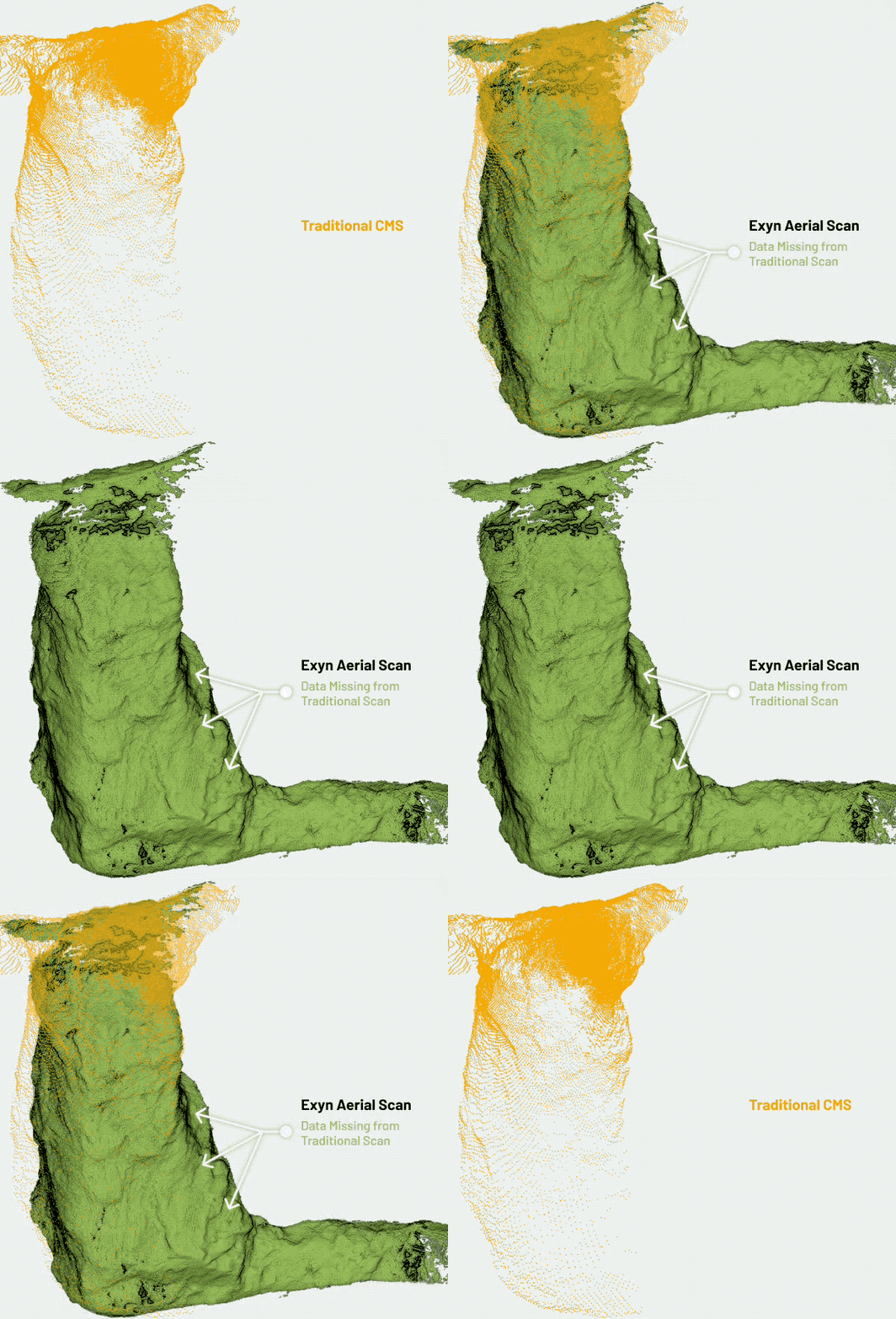 Autonomous drone mapping technology has steadily advanced over the past decade and is frequently deemed as precise as other traditional mapping technologies. Essential to our customers, the ExynAero and ExynPak accurately capture survey-grade point clouds that are processed rapidly for volumetric analysis. Fundamental reasons for this level of detail include:
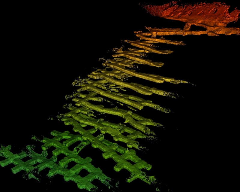
The fusion of point clouds with advanced drone mapping software results in a transformative visualization experience. Every flight, drones capture thousands of data points integrated to create detailed 3D models of underground mines, meaning that features such as tunnels, chambers, and stopes are represented with impeccable detail. Survey teams and project managers precisely understand the site's layout, ensuring better planning and operational execution.
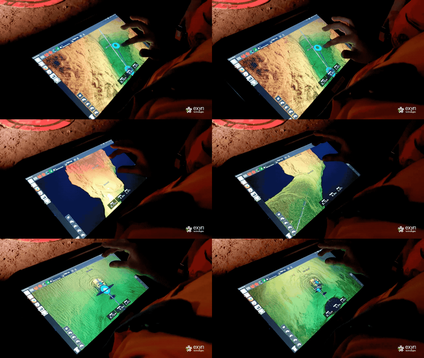
Beyond enhanced safety and accuracy, drones bring significant financial advantages. Manual surveys are time-consuming and labor-intensive, often requiring teams of workers and multiple tools. Drones cover vast areas in a fraction of the time, drastically reducing the hours spent on surveying. This expedited process, combined with reduced labor costs and minimized risks of accidents (and associated liabilities), means that adopting drone technology is a strategic move for operational excellence and a savvy financial decision.
Integrating Exyn drone technology into the mining industry represents a transformative shift that promises safer environments, more accurate data, streamlined operations, and considerable cost savings.

The further survey teams from underground, the safer they are. Remote technologies deliver data without putting human lives at risk. Tele-remote and semi-autonomous systems keep teams above ground and farther away from dangerous areas.
Using traditional methods, survey teams map open, active stopes from their berm, generally considered the most dangerous part of a mine. If a blast happened to break too far under the ridge, it could create a potential collapse into the cavity. Virtual mapping prevents this type of accident. Autonomous drone capabilities permit survey teams to stand 30 or more meters from that berm and fly the robot into unknown cavities.
In addition, remote technologies allow teams to capture scans quickly and often, allowing 3D models of tunnels to be compared over time to monitor for changes. Shifts in the rock could indicate a potential collapse, and awareness saves lives.
 Autonomous drone mapping technology has steadily advanced over the past decade and is frequently deemed as precise as other traditional mapping technologies. Essential to our customers, the ExynAero and ExynPak accurately capture survey-grade point clouds that are processed rapidly for volumetric analysis. Fundamental reasons for this level of detail include:

The fusion of point clouds with advanced drone mapping software results in a transformative visualization experience. Every flight, drones capture thousands of data points integrated to create detailed 3D models of underground mines, meaning that features such as tunnels, chambers, and stopes are represented with impeccable detail. Survey teams and project managers precisely understand the site's layout, ensuring better planning and operational execution.

Beyond enhanced safety and accuracy, drones bring significant financial advantages. Manual surveys are time-consuming and labor-intensive, often requiring teams of workers and multiple tools. Drones cover vast areas in a fraction of the time, drastically reducing the hours spent on surveying. This expedited process, combined with reduced labor costs and minimized risks of accidents (and associated liabilities), means that adopting drone technology is a strategic move for operational excellence and a savvy financial decision.
Integrating Exyn drone technology into the mining industry represents a transformative shift that promises safer environments, more accurate data, streamlined operations, and considerable cost savings.
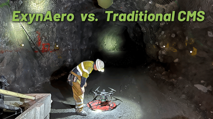
In Ontario, Canada, USCCG — an esteemed operations management consulting firm — teamed up with Exyn Technologies, the vanguard in multi-platform autonomous AI for complex, GPS-denied environments. Their objective? To critically evaluate the ROI and capabilities of the ExynAero, especially its pioneering Autonomy Level 4 (AL4) technology.
The heart of the study revolved around the AL4 technology of the ExynAero during its use in surveying active headings at the Pogo Mine. Notably, the ExynAero has a cutting-edge gimballed-LiDAR sensor, a marvel in cavity mapping surveys inside open stopes.
Ron Tinder, from USCCG, extolled the groundbreaking technology, emphasizing its significant improvements in operational safety and efficiency.
The future of underground mining lies not only in the rich veins of minerals that we extract but in the innovative technologies we employ to achieve efficiency and ensure the safety of our mining personnel. From the intricate passages of the room and pillar formations to the daunting challenges of GPS-denied environments, the ExynAero and ExynPak drones have emerged as trailblazers, setting new standards for mapping, exploration, and real-time data collection in the depths below the Earth's surface.
Integrating autonomous drone technology into the mining sector symbolizes the convergence of tradition and innovation, offering an exciting glimpse into the future of below-ground exploration. With precise 3D mapping, enhanced safety protocols, and cost-effective operations, drones are not just part of the mining industry's future—they're defining it.
For those eager to stay ahead in this rapidly evolving industry, there's no better time to witness firsthand the transformative power of drone mapping. Dive deep into high-precision 3D modeling for mines, and let Exyn Technologies guide the way. Book a demo today to experience the true power of autonomy in action. The journey below the surface promises a future bright with possibilities.