---
title: Drone 3D Mapping Software | Exyn Technologies
description: Uncovering the benefits of autonomous drones for inspection and surveying using groundbreaking 3D drone mapping software.
image: https://www.exyn.com/hubfs/power-of-point-clouds-hero-sm.jpg
---
[ ](https://www.exyn.com/?hsLang=en)
[ Book a Demo ](https://cta-service-cms2.hubspot.com/web-interactives/public/v1/track/click?encryptedPayload=AVxigLLty2nph278fYyW6Go1HdK6TlhD9gGcAsDWA1S2JA1ovKfJP1kwVjquNca0EoM7594sP5AK0MA0lJIZnP3FP%2BV4Uf20jZQTq5BT2ZGlGPCrW4xyXDbJFnToPUp%2FgMdo%2Fkf8zr7MTk0NdzChKE5Okkbl42KJhLgw%2Bs8zsFQ%3D&portalId=8300473)
[ Book a Demo ](https://cta-service-cms2.hubspot.com/web-interactives/public/v1/track/click?encryptedPayload=AVxigLLty2nph278fYyW6Go1HdK6TlhD9gGcAsDWA1S2JA1ovKfJP1kwVjquNca0EoM7594sP5AK0MA0lJIZnP3FP%2BV4Uf20jZQTq5BT2ZGlGPCrW4xyXDbJFnToPUp%2FgMdo%2Fkf8zr7MTk0NdzChKE5Okkbl42KJhLgw%2Bs8zsFQ%3D&portalId=8300473)
  
# Exyn Technologies: The Power of 3D Drone Mapping Software
**

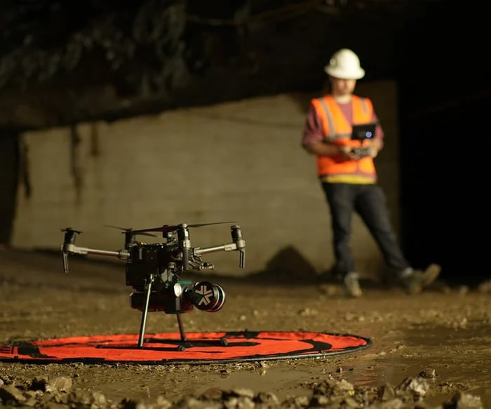
Autonomous drones, once a distant dream of science fiction writers, have rapidly become integral tools to various industries worldwide. Equipped with advanced cameras and sensors, they can capture detailed 3D maps of complex environments while autonomously navigating challenging, dynamic terrain, making tasks like aerial mapping, surveying, and inspection remarkably efficient.
However the data captured is only as good as the **drone 3d mapping software** tasked with the mission. Let's uncover some benefits of this transformative technology to discover which drone 3D mapping software stands out from the pack.
[Exyn Autonomous Drone](https://www.exyn.com/technology/autonomous-robotics-software?hsLang=en)
   
## Why Is Drone Mapping Software Vital For Surveying and Mapping?
With the pace of business moving faster than ever, software solutions with the ability to digitize, analyze, and interpret the physical world has emerged as a keystone workflow across a variety of industries. Equipped with the [most advanced drone autonomy engine](https://www.exyn.com/technology/autonomous-robotics-software?hsLang=en), inspectors and surveyors can explore like never before.
Drone Mapping in Construction
### Enterprise Solutions: Building the Future with Precision and Efficiency
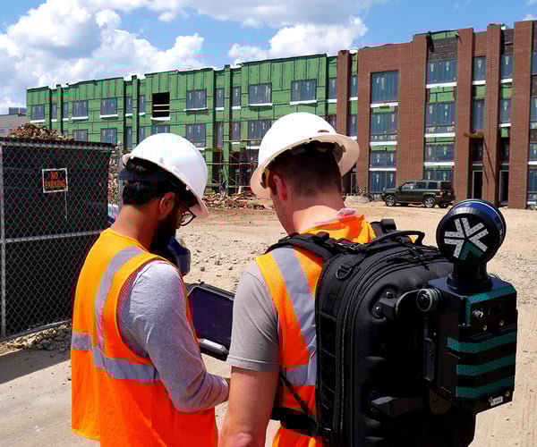
The construction industry, long known for its manual labor and time-intensive processes, is undergoing a digital transformation, with drones playing a pivotal role. Incorporating drone technology into construction mapping missions has enhanced project outcomes and revolutionized how stakeholders view and manage construction projects. Here are some ways that drones make waves in construction:
**Ultra-High-Resolution 3D Models**
- **Design and Planning:** 3D models allow architects, project managers, and engineers to visualize the entire project for better design insights and more accurate planning. [ExynAI-powered drones](https://www.exyn.com/?hsLang=en) capture survey-grade 3D maps of construction sites in progress. Depend upon the autonomous [ExynScout or the portable ExynPak](https://www.exyn.com/industries/construction-inspection-drones?hsLang=en) to track real-time change detection and avoid costly rework.
- **Volume Measurement:** Vital for large infrastructural projects, drones can provide accurate volumetric measurements for excavation pits or determine the quantity of construction materials. At [Level 4A Autonomy](https://www.exyn.com/technology/autonomous-robotics-software?hsLang=en), Exyn’s drones can now freely explore complex spaces with complete flight path determination—at 2+ meter/second flight speeds (2X the previous standard) and with higher quality data collection in larger volumes. In ideal conditions, Exyn’s drones can cover 16 million cubic meters – the equivalent of NINE football stadiums – in a single autonomous flight.
- **Map Stitching:** Easily and accurately align multiple maps into a single, more extensive set of data for comprehensive analysis. By overlaying 3D models from different project stages, discrepancies between planned and actual outcomes can be pinpointed, reducing errors and ensuring the construction remains true to the initial design.
**Fast Autonomous Data Capture**
- **Site Assessment:** Construction projects demand rigorous site assessments before laying a foundation. Traditionally, this required labor-intensive ground surveys. Exyn robots can be deployed anywhere, flying beyond the visual line of sight and capturing data in both indoor and outdoor environments. This rapid capture is invaluable for initial site evaluations, tracking daily progress, or monitoring a vast lot or construction site.
- **Change Detection:** With ExynAI's [Simultaneous Localization and Mapping (SLAM)](https://www.exyn.com/technology/lidar-mapping-technology?hsLang=en) engine, operators can duplicate the same mission and precisely georeference the data gathered to compare results and flag issues before they compound.
- **Onsite Post-Processing:** Survey teams process data on the tablet when the ExynScout returns home. Whether they are still on-site or back at the control center, the entire process takes less time than the flight.
**Simplified Workflow for Inspections and Documentation**
- **Safety Inspections:** Safety inspections in construction sites can be risky. ExynAI uses high-resolution Velodyne Lidar sensors to gather survey 3D maps and conduct surveys of industrial environments. From checking scaffoldings to evaluating the structural integrity of exposed beams, drones can easily access hard-to-reach areas, maximizing onsite safety.
- **Documentation:** Regular documentation is vital for construction, ensuring all stakeholders are updated and validating the work per regulatory standards. Drones streamline this, providing daily, weekly, or monthly aerial footage that can be archived for future reference or used for stakeholder presentations.
- **Issue Identification:** Drones equipped with photogrammetry can detect change and quickly spot construction anomalies or deviations with detailed aerial vantage points. Early identification means faster resolutions, ensuring projects remain on schedule.
The bottom line? Exyn solutions empower construction managers with real-time 3D models, preserving time building a complete BIM, preventing costly overwork through early issue detection, and protecting lives by keeping workers away from dangerous areas. [Learn more about drones in construction here](https://www.exyn.com/industries/construction-inspection-drones?hsLang=en).
Autonomous Drones in Mining
### Mining: Digging Deep with Autonomous Drones
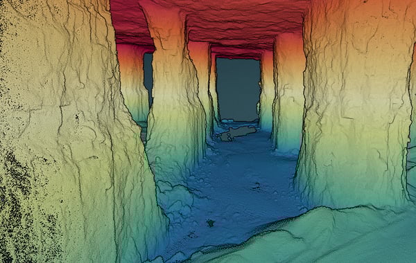
At Exyn, we have been at the forefront of developing [drone 3D mapping software to meet the unique demands of the mining sector](https://www.exyn.com/industries/mining-cavity-monitoring-system?hsLang=en). From cutting down on labor-intensive tasks to providing more accurate data, the industry is rife with opportunities to use drones for mining exploration. Let's uncover drones' multi-faceted advantages to the mining arena:
**Fast Autonomous Data Capture**
- **Site Exploration:** The initial phases of mining hinge on thorough site exploration. Drones, equipped with specialized sensors, swiftly traverse potential mining zones. ExynAI can explore a volume or target a waypoint to capture data on mineral composition, soil type, and rock formations to help identify areas rich in desired resources, drastically reducing exploration costs and time in a flight launched from a tablet, not a controller.
- **GPS-Denied Navigation:** Piloted by ExynAI, the [ExynAero](https://www.exyn.com/products/exyn-aero-aerial-mapping-drone?hsLang=en) analyzes a subterranean environment to identify the safest, most efficient flight path. With all intelligence onboard, the ExynAero flies beyond-visual-line-of-sight (BVLOS), outside communications range, and without GPS.
- **Operational Monitoring:** The pulse of a mining operation is its day-to-day activities. Drones offer a bird's-eye view of extraction sites, capturing real-time data to monitor equipment functionality, worker safety, and overall productivity, facilitating immediate adjustments to streamline operations.
**Ultra-High-Resolution 3D Models**
- **Volume Estimation:** In the mining industry, accuracy in volume estimation is paramount. Ultra-high-resolution 3D models crafted from drone-captured data provide unparalleled excavated area details. These insights enable companies to gauge the volume of minerals extracted, optimize inventory storage, and plan future extraction endeavors.
- **Real-Time, Precise Renderings:** Fusing dense point clouds with advanced drone mapping software results in a transformative visualization experience. Every flight, drones capture thousands of data points integrated to create detailed 3D models of underground mines, meaning that features such as tunnels, chambers, and stopes are represented with impeccable detail. Survey teams and project managers precisely understand the site's layout, ensuring better planning and operational execution.
**Simplified Workflow for Inspections and Documentation**
- **Stockpile Management:** Accurate measurement of stockpiles is vital for inventory control and financial reporting. Drones measure volumes with pinpoint accuracy, replacing traditional methods that often result in errors. Automated and frequent stockpile measurements ensure that inventory data is always up-to-date and reliable.
- **Safety Protocols:** Autonomous drone 3D mapping technologies allow teams to capture scans quickly and often, allowing 3D models of tunnels to be compared over time to monitor for changes. Shifts in the rock could indicate a potential collapse, and awareness saves lives.
- **Environmental Compliance:** Stringent regulations mandate the delicate balance between mineral extraction and ecological conservation. Drones simplify capturing comprehensive data on environmental impact, flora and fauna disturbances, and reclamation efforts, ensuring companies remain compliant while championing environmental harmony.
3D Mapping for Agriculture
### Precision Agriculture: Sowing the Seeds of Precision
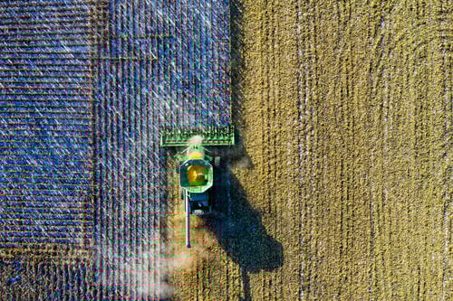
While the construction industry stands tall, benefiting from the precise intricacies of drone mapping, our agricultural fields, too, are experiencing a revolution from drone 3D mapping technology. These sprawling stretches of green are now being optimized, analyzed, and meticulously managed, all from the skies above. Let's delve into how 3D models and DEMs via mapping software drones are reshaping modern agriculture.
**Ultra-High-Resolution 3D Models**
- **Yield Estimation:** With the sharp visuals provided by ultra-high-resolution 3D models and autonomous outdoor flight, farmers can estimate their produce volumes with enhanced precision, resulting in better market predictions, inventory planning, and improved profitability.
- **Terrain Analysis:** Every field has its unique topographical challenges and advantages. High-resolution 3D models via photogrammetry software depict field elevations, slopes, and depressions. This invaluable data aids in devising optimal plantation techniques, water flow strategies, and harvesting routes, ensuring farmers utilize every patch of land to its fullest potential.
**Fast, Autonomous Data Capture**
- **Crop Health Monitoring:** With the speed and agility of drones powered by ExynAI 3D mapping software capable our outdoor flight, farmers can now scan vast stretches of crops in mere minutes. These aerial inspections help identify subtle color variations indicating potential pest infestations or fungal outbreaks. Acting on this real-time data means immediate intervention, salvaging yields that might otherwise be lost.
- **Irrigation Management:** Water, the lifeblood of agriculture, often determines the line between a bountiful harvest and a disappointing yield. With the drones' aerial perspective, inconsistencies in irrigation patterns become starkly evident. Whether due to malfunctioning sprinklers or terrain-induced water runoffs, drones ensure farmers are acutely aware, allowing for timely adjustments.
**Simplified Workflow for Inspections and Documentation**
- **Regulatory Compliance:** Modern agriculture is often bound by stringent regulations—organic certifications, pesticide use limits, and water conservation norms, to name a few. Drone-captured data assists in maintaining transparent, accurate documentation, ensuring farmers remain compliant and eligible for relevant subsidies or certifications.
- **Land Record Management:** For larger agri-businesses or cooperative farming ventures, precise land demarcation is essential. Drone-generated maps capture every boundary, preventing disputes and ensuring proper land utilization.
### Enterprise Solutions: Building the Future with Precision and Efficiency

The construction industry, long known for its manual labor and time-intensive processes, is undergoing a digital transformation, with drones playing a pivotal role. Incorporating drone technology into construction mapping missions has enhanced project outcomes and revolutionized how stakeholders view and manage construction projects. Here are some ways that drones make waves in construction:
**Ultra-High-Resolution 3D Models**
- **Design and Planning:** 3D models allow architects, project managers, and engineers to visualize the entire project for better design insights and more accurate planning. [ExynAI-powered drones](https://www.exyn.com/?hsLang=en) capture survey-grade 3D maps of construction sites in progress. Depend upon the autonomous [ExynScout or the portable ExynPak](https://www.exyn.com/industries/construction-inspection-drones?hsLang=en) to track real-time change detection and avoid costly rework.
- **Volume Measurement:** Vital for large infrastructural projects, drones can provide accurate volumetric measurements for excavation pits or determine the quantity of construction materials. At [Level 4A Autonomy](https://www.exyn.com/technology/autonomous-robotics-software?hsLang=en), Exyn’s drones can now freely explore complex spaces with complete flight path determination—at 2+ meter/second flight speeds (2X the previous standard) and with higher quality data collection in larger volumes. In ideal conditions, Exyn’s drones can cover 16 million cubic meters – the equivalent of NINE football stadiums – in a single autonomous flight.
- **Map Stitching:** Easily and accurately align multiple maps into a single, more extensive set of data for comprehensive analysis. By overlaying 3D models from different project stages, discrepancies between planned and actual outcomes can be pinpointed, reducing errors and ensuring the construction remains true to the initial design.
**Fast Autonomous Data Capture**
- **Site Assessment:** Construction projects demand rigorous site assessments before laying a foundation. Traditionally, this required labor-intensive ground surveys. Exyn robots can be deployed anywhere, flying beyond the visual line of sight and capturing data in both indoor and outdoor environments. This rapid capture is invaluable for initial site evaluations, tracking daily progress, or monitoring a vast lot or construction site.
- **Change Detection:** With ExynAI's [Simultaneous Localization and Mapping (SLAM)](https://www.exyn.com/technology/lidar-mapping-technology?hsLang=en) engine, operators can duplicate the same mission and precisely georeference the data gathered to compare results and flag issues before they compound.
- **Onsite Post-Processing:** Survey teams process data on the tablet when the ExynScout returns home. Whether they are still on-site or back at the control center, the entire process takes less time than the flight.
**Simplified Workflow for Inspections and Documentation**
- **Safety Inspections:** Safety inspections in construction sites can be risky. ExynAI uses high-resolution Velodyne Lidar sensors to gather survey 3D maps and conduct surveys of industrial environments. From checking scaffoldings to evaluating the structural integrity of exposed beams, drones can easily access hard-to-reach areas, maximizing onsite safety.
- **Documentation:** Regular documentation is vital for construction, ensuring all stakeholders are updated and validating the work per regulatory standards. Drones streamline this, providing daily, weekly, or monthly aerial footage that can be archived for future reference or used for stakeholder presentations.
- **Issue Identification:** Drones equipped with photogrammetry can detect change and quickly spot construction anomalies or deviations with detailed aerial vantage points. Early identification means faster resolutions, ensuring projects remain on schedule.
The bottom line? Exyn solutions empower construction managers with real-time 3D models, preserving time building a complete BIM, preventing costly overwork through early issue detection, and protecting lives by keeping workers away from dangerous areas. [Learn more about drones in construction here](https://www.exyn.com/industries/construction-inspection-drones?hsLang=en).
### Mining: Digging Deep with Autonomous Drones

At Exyn, we have been at the forefront of developing [drone 3D mapping software to meet the unique demands of the mining sector](https://www.exyn.com/industries/mining-cavity-monitoring-system?hsLang=en). From cutting down on labor-intensive tasks to providing more accurate data, the industry is rife with opportunities to use drones for mining exploration. Let's uncover drones' multi-faceted advantages to the mining arena:
**Fast Autonomous Data Capture**
- **Site Exploration:** The initial phases of mining hinge on thorough site exploration. Drones, equipped with specialized sensors, swiftly traverse potential mining zones. ExynAI can explore a volume or target a waypoint to capture data on mineral composition, soil type, and rock formations to help identify areas rich in desired resources, drastically reducing exploration costs and time in a flight launched from a tablet, not a controller.
- **GPS-Denied Navigation:** Piloted by ExynAI, the [ExynAero](https://www.exyn.com/products/exyn-aero-aerial-mapping-drone?hsLang=en) analyzes a subterranean environment to identify the safest, most efficient flight path. With all intelligence onboard, the ExynAero flies beyond-visual-line-of-sight (BVLOS), outside communications range, and without GPS.
- **Operational Monitoring:** The pulse of a mining operation is its day-to-day activities. Drones offer a bird's-eye view of extraction sites, capturing real-time data to monitor equipment functionality, worker safety, and overall productivity, facilitating immediate adjustments to streamline operations.
**Ultra-High-Resolution 3D Models**
- **Volume Estimation:** In the mining industry, accuracy in volume estimation is paramount. Ultra-high-resolution 3D models crafted from drone-captured data provide unparalleled excavated area details. These insights enable companies to gauge the volume of minerals extracted, optimize inventory storage, and plan future extraction endeavors.
- **Real-Time, Precise Renderings:** Fusing dense point clouds with advanced drone mapping software results in a transformative visualization experience. Every flight, drones capture thousands of data points integrated to create detailed 3D models of underground mines, meaning that features such as tunnels, chambers, and stopes are represented with impeccable detail. Survey teams and project managers precisely understand the site's layout, ensuring better planning and operational execution.
**Simplified Workflow for Inspections and Documentation**
- **Stockpile Management:** Accurate measurement of stockpiles is vital for inventory control and financial reporting. Drones measure volumes with pinpoint accuracy, replacing traditional methods that often result in errors. Automated and frequent stockpile measurements ensure that inventory data is always up-to-date and reliable.
- **Safety Protocols:** Autonomous drone 3D mapping technologies allow teams to capture scans quickly and often, allowing 3D models of tunnels to be compared over time to monitor for changes. Shifts in the rock could indicate a potential collapse, and awareness saves lives.
- **Environmental Compliance:** Stringent regulations mandate the delicate balance between mineral extraction and ecological conservation. Drones simplify capturing comprehensive data on environmental impact, flora and fauna disturbances, and reclamation efforts, ensuring companies remain compliant while championing environmental harmony.
### Precision Agriculture: Sowing the Seeds of Precision

While the construction industry stands tall, benefiting from the precise intricacies of drone mapping, our agricultural fields, too, are experiencing a revolution from drone 3D mapping technology. These sprawling stretches of green are now being optimized, analyzed, and meticulously managed, all from the skies above. Let's delve into how 3D models and DEMs via mapping software drones are reshaping modern agriculture.
**Ultra-High-Resolution 3D Models**
- **Yield Estimation:** With the sharp visuals provided by ultra-high-resolution 3D models and autonomous outdoor flight, farmers can estimate their produce volumes with enhanced precision, resulting in better market predictions, inventory planning, and improved profitability.
- **Terrain Analysis:** Every field has its unique topographical challenges and advantages. High-resolution 3D models via photogrammetry software depict field elevations, slopes, and depressions. This invaluable data aids in devising optimal plantation techniques, water flow strategies, and harvesting routes, ensuring farmers utilize every patch of land to its fullest potential.
**Fast, Autonomous Data Capture**
- **Crop Health Monitoring:** With the speed and agility of drones powered by ExynAI 3D mapping software capable our outdoor flight, farmers can now scan vast stretches of crops in mere minutes. These aerial inspections help identify subtle color variations indicating potential pest infestations or fungal outbreaks. Acting on this real-time data means immediate intervention, salvaging yields that might otherwise be lost.
- **Irrigation Management:** Water, the lifeblood of agriculture, often determines the line between a bountiful harvest and a disappointing yield. With the drones' aerial perspective, inconsistencies in irrigation patterns become starkly evident. Whether due to malfunctioning sprinklers or terrain-induced water runoffs, drones ensure farmers are acutely aware, allowing for timely adjustments.
**Simplified Workflow for Inspections and Documentation**
- **Regulatory Compliance:** Modern agriculture is often bound by stringent regulations—organic certifications, pesticide use limits, and water conservation norms, to name a few. Drone-captured data assists in maintaining transparent, accurate documentation, ensuring farmers remain compliant and eligible for relevant subsidies or certifications.
- **Land Record Management:** For larger agri-businesses or cooperative farming ventures, precise land demarcation is essential. Drone-generated maps capture every boundary, preventing disputes and ensuring proper land utilization.

## The Technical Marvel Behind 3D Photogrammetry Software
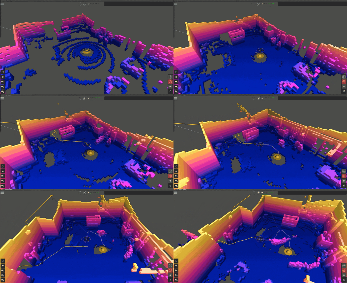
3D drone mapping is a technology-driven process in which unmanned aerial vehicles (UAVs) are equipped with high-resolution cameras or specialized LiDAR sensors to capture snapshots of an unknown environment. This data can then be processed using a powerful Simultaneous Localization and Mapping (SLAM) algorithm to create detailed 3D models of a complex, unknown environment.
The essence of 3D mapping for UAVs lies in the LiDAR-based SLAM algorithm, or autonomy engine, called ExynAI.
[LiDAR SLAM Technology](https://www.exyn.com/lidar-mapping-technology?hsLang=en)
   
## Features to Look for in 3D Drone Mapping Technology
In the vast landscape of mapping and surveying using [LiDAR Drone](https://www.exyn.com/lidar-drone?hsLang=en), software choices abound for [drone mapping companies](https://www.exyn.com/drone-mapping-companies?hsLang=en). The options can seem overwhelming, from industrial solutions to open-source software. But certain standout features can help you select the best drone mapping software for your needs.
User-Friendly Navigation
### User-Friendly Navigation
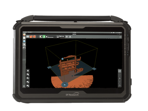
At the core of effective software lies an intuitive interface, ensuring even first time operators of an autonomous robot can navigate the platform and plan missions easily. At Exyn, we provide comprehensive training before your robot is deployed.
Comprehensive Workflow
### Comprehensive Workflow
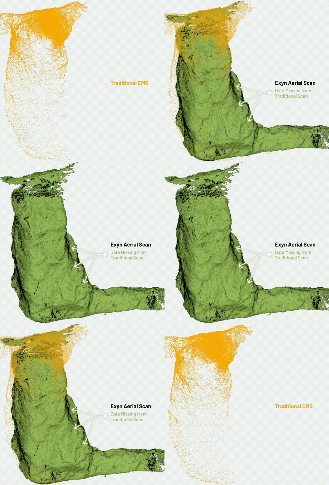
An end-to-end post-processing pipeline distinguishes superior software, guiding users from the initial mission planning and data capture to final map generation and export. Using ExynAI, operators can quickly process flight data into 3D models in a fraction of the time compared to traditional software and all on site via a ruggedized tablet.
Precision Data Capture
### Precision Data Capture
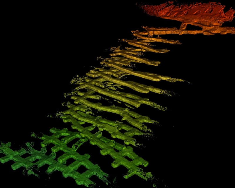
The fusion of point clouds with advanced drone mapping software results in a transformative visualization experience. Every flight, drones capture thousands of data points integrated to create detailed 3D models of underground mines, meaning that features such as tunnels, chambers, and stopes are represented with impeccable detail. Survey teams and project managers precisely understand the site's layout, ensuring better planning and operational execution.
Cost-Effectiveness
### Cost-Effectiveness
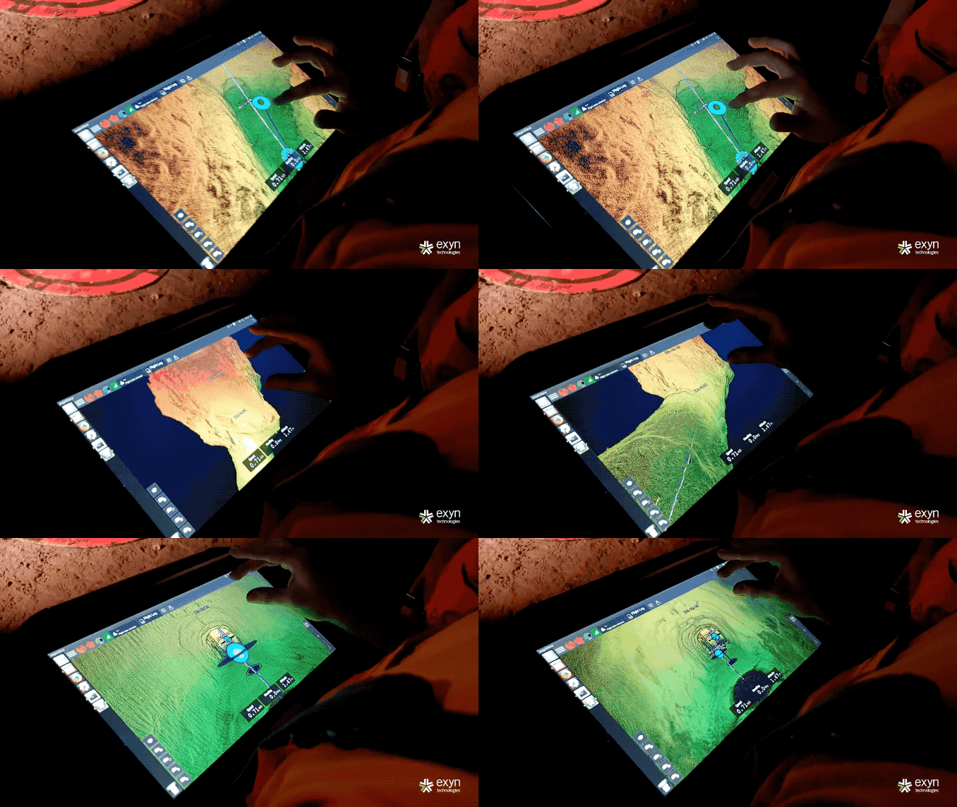
Beyond enhanced safety and accuracy, drones bring significant financial advantages. Manual surveys are time-consuming and labor-intensive, often requiring teams of workers and multiple tools. Drones cover vast areas in a fraction of the time, drastically reducing the hours spent on surveying. This expedited process, combined with reduced labor costs and minimized risks of accidents (and associated liabilities), means that adopting drone technology is a strategic move for operational excellence and a savvy financial decision.
Integrating Exyn drone technology into the mining industry represents a transformative shift that promises safer environments, more accurate data, streamlined operations, and considerable cost savings.
### User-Friendly Navigation

At the core of effective software lies an intuitive interface, ensuring even first time operators of an autonomous robot can navigate the platform and plan missions easily. At Exyn, we provide comprehensive training before your robot is deployed.
### Comprehensive Workflow

An end-to-end post-processing pipeline distinguishes superior software, guiding users from the initial mission planning and data capture to final map generation and export. Using ExynAI, operators can quickly process flight data into 3D models in a fraction of the time compared to traditional software and all on site via a ruggedized tablet.
### Precision Data Capture

The fusion of point clouds with advanced drone mapping software results in a transformative visualization experience. Every flight, drones capture thousands of data points integrated to create detailed 3D models of underground mines, meaning that features such as tunnels, chambers, and stopes are represented with impeccable detail. Survey teams and project managers precisely understand the site's layout, ensuring better planning and operational execution.
### Cost-Effectiveness

Beyond enhanced safety and accuracy, drones bring significant financial advantages. Manual surveys are time-consuming and labor-intensive, often requiring teams of workers and multiple tools. Drones cover vast areas in a fraction of the time, drastically reducing the hours spent on surveying. This expedited process, combined with reduced labor costs and minimized risks of accidents (and associated liabilities), means that adopting drone technology is a strategic move for operational excellence and a savvy financial decision.
Integrating Exyn drone technology into the mining industry represents a transformative shift that promises safer environments, more accurate data, streamlined operations, and considerable cost savings.

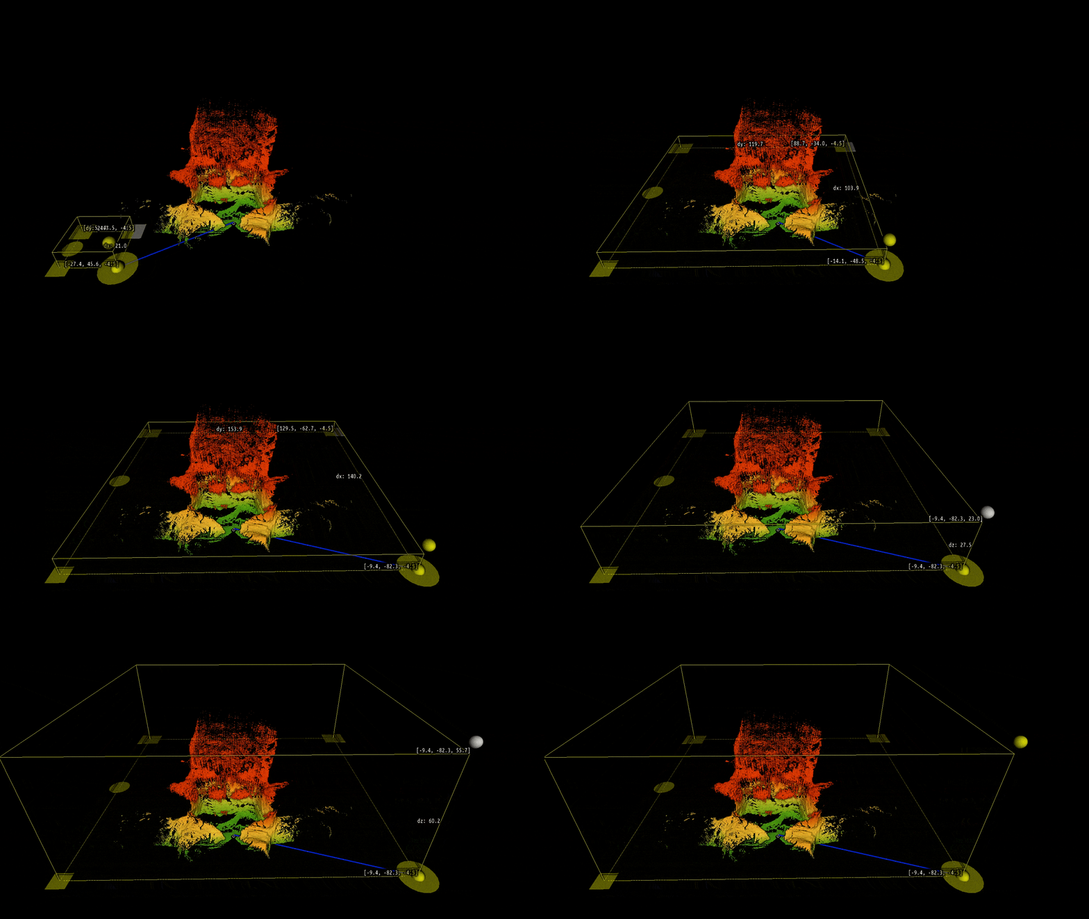
Fly along with ExynAI
## Level 4 Aerial Autonomy: The Exyn Advantage
ExynAI allows teams worldwide to explore the most dangerous and remote places with multi-platform autonomy. Our robots feature cutting-edge pilotless technology that delivers high-fidelity 3D data from challenging, GPS-denied locations.
Level 4 aerial autonomy is the most sophisticated 3D aerial autonomy available. Unlike previous industry standards of aerial autonomy that use waypoints and multiple flights to obtain adequate intelligence, Exyn’s Level 4A drones require no human interaction during flights.
[Learn More about Exyn Aero](https://www.exyn.com/products/exyn-aero-dj34?hsLang=en)

eyebrow text
## Mission Planning with ExynAI
Exyn’s autonomous drones launch from a tablet, not a controller. Once in flight, ExynAI identifies unexplored space within a set volume and navigates intelligently for maximum data collection of expansive areas. Survey teams visualize what the robot sees throughout the mission, ensuring all necessary data is captured, even within comms-denied environments. With all processing housed onboard, Exyn robots can execute a task without constant communications or existing infrastructures like GPS, WiFi beacons, landmarks, or pre-loaded map data.
Exyn robots navigate intelligently during flight to recognize and avoid static and dynamic objects. Employing multiple sensing modalities (LiDAR, inertial sensors, and our SLAM pipeline), our drones maintain a safe distance to avoid collisions and adapt to sensor failures and varying conditions, such as dust or degraded lighting, in real-time.
   
## Advanced Analysis with Exyn's 3D Mapping Software
While autonomous flight and data collection are impressive feats in themselves, the true value of drone technology is in post-flight data processing and analysis.
Real-Time Data Processing
### Real-Time Data Processing
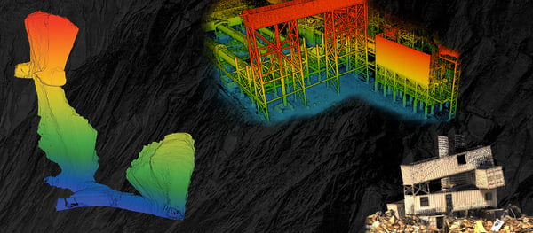
Other drone companies require teams to upload the captured raw data for post-processing. Exyn technology is different. Everything happens on board the tablet, so teams simply have to download the log from the robot. Then, using the same software used to plan the mission – ExView – users can post-process the log, clean/smooth it, downsample it for easier file sharing, colorize the log, geo-reference it, remove any non-static points, and finally export it into a point cloud format: .ply, .las, or .xyz. Exyn Technologies' advanced 3D mapping software delivers features that elevate the post-flight phase to unprecedented heights.
Seamless Data Integration
### Seamless Data Integration
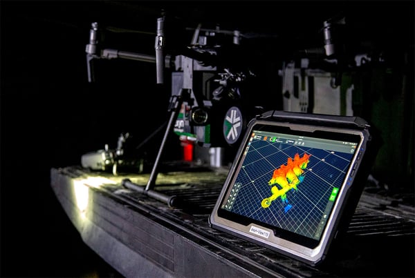
The software ensures compatibility with other industry-standard tools and platforms. This seamless integration means that data from Exyn's drones can be easily imported into CAD software, GIS platforms, and other analytical tools, making it a versatile addition to any professional's toolkit.
Enhanced Visualization Tools
### Enhanced Visualization Tools
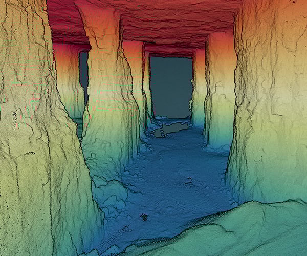
Post-flight analysis isn't just about numbers and coordinates. Exyn's software provides [detailed 3D visualizations](https://www.exyn.com/technology/point-cloud-data-visualization?hsLang=en), enabling users to immerse themselves in the data. These visual tools can be manipulated, scaled, and rotated, granting a holistic understanding of the mapped area. Moreover, layers can be added or removed, allowing for a granular focus or broad overview.
[](https://cta-redirect.hubspot.com/cta/redirect/8300473/55e7b33b-c8b1-43dc-82cf-49ffb0d0cedd)
Multi-Platform Autonomy
### Multi-Platform Autonomy
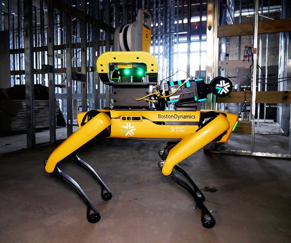
ExynAI software can integrate with any robotic platform, so missions are not constrained to just aerial platforms. (Read about our autonomy working on a quadruped robot like Boston Dynamics Spot [here](https://www.robotics247.com/article/exyn_technologies_and_trimble_outfit_boston_dynamics_spot_with_3d_scanning_and_mapping_systems_for_use_in_construction_industry).) Exyn's autonomy and 3D mapping solutions are revolutionizing mining, construction, and infrastructure inspection, but we're not stopping there.
Our technology can change the world. In the future, we will continue to move into wheeled and tracked robots and, eventually, underwater and even space robots. If you can control a robot with two joysticks, ExynAI can pilot it with suitable sensors.
Post-flight analysis is where the rubber meets the road in drone technology. Exyn Technologies' sophisticated 3D mapping software ensures that every byte of data captured in flight is processed, analyzed, and presented with utmost precision and clarity. By merging cutting-edge technology with user-centric design, Exyn is redefining the [future of drone data analysis](https://www.exyn.com/news/future-of-work-with-autonomous-drones?hsLang=en).
[](https://cta-redirect.hubspot.com/cta/redirect/8300473/57396f92-3fbc-42c5-bbd2-fbf6fcbf28fe)
### Real-Time Data Processing

Other drone companies require teams to upload the captured raw data for post-processing. Exyn technology is different. Everything happens on board the tablet, so teams simply have to download the log from the robot. Then, using the same software used to plan the mission – ExView – users can post-process the log, clean/smooth it, downsample it for easier file sharing, colorize the log, geo-reference it, remove any non-static points, and finally export it into a point cloud format: .ply, .las, or .xyz. Exyn Technologies' advanced 3D mapping software delivers features that elevate the post-flight phase to unprecedented heights.
### Seamless Data Integration

The software ensures compatibility with other industry-standard tools and platforms. This seamless integration means that data from Exyn's drones can be easily imported into CAD software, GIS platforms, and other analytical tools, making it a versatile addition to any professional's toolkit.
### Enhanced Visualization Tools

Post-flight analysis isn't just about numbers and coordinates. Exyn's software provides [detailed 3D visualizations](https://www.exyn.com/technology/point-cloud-data-visualization?hsLang=en), enabling users to immerse themselves in the data. These visual tools can be manipulated, scaled, and rotated, granting a holistic understanding of the mapped area. Moreover, layers can be added or removed, allowing for a granular focus or broad overview.
[](https://cta-redirect.hubspot.com/cta/redirect/8300473/55e7b33b-c8b1-43dc-82cf-49ffb0d0cedd)
### Multi-Platform Autonomy

ExynAI software can integrate with any robotic platform, so missions are not constrained to just aerial platforms. (Read about our autonomy working on a quadruped robot like Boston Dynamics Spot [here](https://www.robotics247.com/article/exyn_technologies_and_trimble_outfit_boston_dynamics_spot_with_3d_scanning_and_mapping_systems_for_use_in_construction_industry).) Exyn's autonomy and 3D mapping solutions are revolutionizing mining, construction, and infrastructure inspection, but we're not stopping there.
Our technology can change the world. In the future, we will continue to move into wheeled and tracked robots and, eventually, underwater and even space robots. If you can control a robot with two joysticks, ExynAI can pilot it with suitable sensors.
Post-flight analysis is where the rubber meets the road in drone technology. Exyn Technologies' sophisticated 3D mapping software ensures that every byte of data captured in flight is processed, analyzed, and presented with utmost precision and clarity. By merging cutting-edge technology with user-centric design, Exyn is redefining the [future of drone data analysis](https://www.exyn.com/news/future-of-work-with-autonomous-drones?hsLang=en).
[](https://cta-redirect.hubspot.com/cta/redirect/8300473/57396f92-3fbc-42c5-bbd2-fbf6fcbf28fe)
## The Autonomous Revolution: Transforming Tomorrow with ExynAI
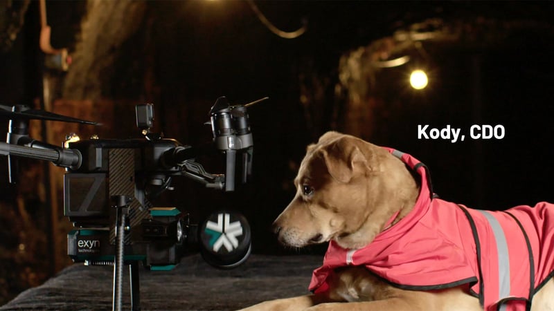
In the tapestry of technological marvels, drones have woven a narrative that seamlessly marries the dreams of yesteryears with today's innovations. From the heartbeats of construction sites to the serene hum of vast agricultural fields and the rugged workflows of underground mining environments, drone technology has reshaped our world's vista. At the helm of this transformation is Exyn Technologies, offering an immersive journey into the future with its 3D mapping software.
As we soar into the horizon of possibilities, one thing remains clear: The future beckons, and with Exyn, it's not a distant dream but an accessible reality. Why remain grounded when the skies are calling?
Dive into the future with us. Schedule a demo and experience firsthand the transformative power of 3D mapping software with Exyn drone technology.
## Schedule Your Demo Today

Copyright © 2026 Exyn Technologies.
[(215) 999-0200](tel:+1%20215%20999-0200)
[Contact Us](https://www.exyn.com/about/contact?hsLang=en)